For years now, we’ve been able to collect data from the real world – whether it be via photographs, imagery, or laser scanning – and turn that data into a 3D model. This is not really new technology, particularly relative to other developments in the technology space, but significant advancements have been made for the entire workflow. On the hardware side, it’s becoming easier to collect this data than ever before thanks to both easier-to-use equipment and machines becoming cheaper. Processing the data is also more accessible and significantly quicker to complete.
There’s also the third piece to these models, which is actually rendering them and applying them to work. This is the area in which we’ve arguably seen the most advancement over the last few years, something that we’ve covered extensively here at Geo Week News. There have been new ways to view these scenes, ways to render them more effectively, and standards being built up to ensure more end users can properly work with data that is growing more readily available and more en vogue across multiple industries. Below are a handful of examples of this coverage from the last year or so.
How Gaming Engines are Fueling Geospatial Workflows
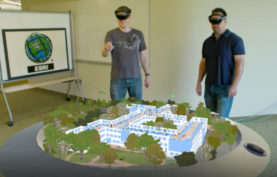
We start with a recent story looking at a space that is not necessarily brand new but is growing significantly, with geospatial data being rendered through game engines. As the story gets into, this can and is done with both mixed reality (i.e., virtual and augmented reality) as well as on desktop viewers. The article includes insights from Rex Hansen, who works as a product manager with Esri and sees first-hand how companies are utilizing these workflows. Hansen shares the advantages of using game engines for this work, the different types of work he’s seen that have utilized either Epic or Unity’s engine (Esri has an SDK for each), and where he sees things going from here.
USD can unlock the 3D ecosystem
In terms of rendering 3D environments and enabling a broader 3D ecosystem, perhaps no tool has seen more momentum than the Universal Scene Description, or USD. Originally created by Pixar, it has been borrowed by many other industries in the years since and now has significant backing for acting, as some have described it, as what HTML is for the traditional internet. There is still a ways to go for that, but some of the world’s largest companies – including but not limited to Apple, NVIDIA, and of course Pixar – founded the Alliance for OpenUSD in 2023 with the aim of growing its usage across industry. This article looks at how USD can help unlock the next step in developing a true 3D ecosystem.

Why Trimble has joined the Alliance for OpenUSD
We’ll stick with USD with this one with a look more specifically at the aforementioned Alliance for OpenUSD. We name-dropped some of the founding members above, but since the group’s founding last year there have been a bevy of other companies joining the Alliance, including Trimble. Recently, Geo Week News spoke with Sean Snyders of Trimble about the ultimate goals of the alliance broadly, and where USD fits into the future of AEC and geospatial businesses.
NVIDIA's Neuralangelo is now source available
NVIDIA is one of the most buzzworthy companies on planet Earth at the moment, though most of that attention is focused on their chip business which is helping to fuel the current AI boom through which we are all living. That’s not the only work they’re doing, though, and not even the only work which ties into the AI boom. In 2022, the company introduced their Instant NeRF technology to change the way photogrammetry work is done. Then, last summer, they introduced their Neuralangelo tool which uses AI to convert 2D videos into an accurate 3D model. A few months later, they made the source code available to all.
Gaussian Splatting is new, but quickly gaining favor
NeRFs didn’t have all that much time to themselves in the sun that is 3D scene rendering, as a 2023 paper introducing Gaussian Splats has already begun to take the industry by storm. This is still an extremely new strategy for this type of work, so it’s not at all commonplace and is still more of a fun thing professionals are trying rather than a mainstay in their work. That being said, its acceptance is growing widely, with a number of examples popping up on social media showcasing how well this technology has worked in a few different contexts.
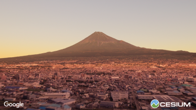
Cesium announces new partnership with Google Maps Platform
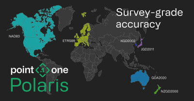
Cesium’s 3D Tiles were first introduced in 2015, and later became the Open Geospatial Consortium’s 3D Tiles standard. Now, they can be used with Google Maps Platform’s massive dataset thanks to a partnership that was announced in the first half of last year. In this article, Geo Week News spoke with Cesium’s Lisa Bos, who explained how 3D Tiles work, how they became an OGC standard, and what was added for end users thanks to the partnership with Google Maps Platform.