
In 2011, Utah DOT famously leveraged LiDAR data for an “asset management leap.” They made news by using the technology to produce the first full inventory of DOT assets anywhere in the US. In the years since, the organization has had time to live with the LiDAR data, learn some important lessons, and determine how to leverage it for maximum benefit.
To find out what they’ve learned, I spoke with then-director of UDOT asset management Stan Burns. He laid out a surprisingly simple way to squeeze more value from your 3D data.
Make the Data Available to Everyone
LiDAR can be used for a lot more than an inventory of assets. The problem, as Burns explains it, is that the data is often left residing with one person. Even powerful data like LiDAR isn’t very useful when you don’t make it available to everyone who needs it.
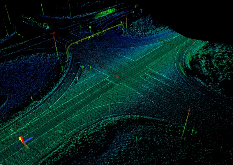
UDOT LiDAR Data
This is why UDOT developed internal business tools like Uplan, a web-based GIS platform that users can access to customize and share maps of geospatially located data. Using Uplan, everyone can access the same data quickly.
Burns talks about a “big breakthrough” when UDOT made the LiDAR data available on this system alongside the DOT’s other information assets. “You make LiDAR data available to everyone through mapping,” he says, “and people are able to more efficiently do their jobs. Anybody who has a browser, anybody who has a computer can do analysis.”
With Uplan in place to share the data across the whole enterprise, information silos aren’t a problem anymore.
Employees can do more than pull simple lists of assets like the number of signs, or the number of signs where the speed limit is 50 miles per hour. Crucially, they can also perform analysis to answer important questions quickly. They can answer the question, How many places are the speed limit 50 miles per hour where there is a prevalence of people running off the road? They can, in other words, save lives.
Benefits: Hard Numbers
You want hard numbers. How much did they save? UDOT says that their comprehensive inventory of assets gathered from LiDAR data allows divisions to examine roadway features from the office rather than sending employees out into the field. This means an estimated $200,000 saved annually on labor.
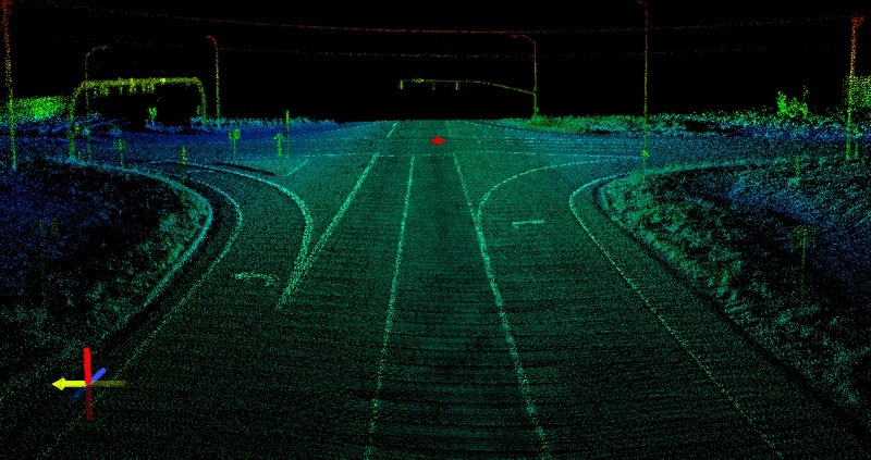
UDOT LiDAR Data
But there are ways to use LiDAR that offer even bigger benefits. LiDAR data can be “retroactively mined” for information no one knew they needed yet, so it saves employees the trouble of going back into the field to gather data. Here, UDOT estimates labor-related savings of almost $600,000, or 80%, per year.
UDOT employees have used LiDAR data to mine information that allows them to calculate material needs and cost estimates for pavement rehab projects, rank the priority of projects according to safety needs, and identify high-risk locations.
If you make the information available to everybody, Burns says, they’ll surprise you with how they use it.
“The most gratifying time was when I would be talking to staff that I was involved with 20 years ago, and they would say, “I can do the following with this information.” A light bulb would go off in my head. That’s the power of the internet: You make this information available, and people will use it.”
Even Bigger Benefits
These numbers are just estimates based on the cost of labor. The real benefits are likely much larger—one department estimate argues that the savings derived from improved communication, increased safety, and better decision making could “arguably result in two to five times” the savings outlined above.
Burns argues that it’s easy to talk about how much you paid for a solution, but it can be difficult to track the true return on your investment.
“What’s the cost of making bad decisions because you don’t have the data? What’s the cost of making decisions based on partial information? Go back to that sign question—How many places are the speed limit 50 miles per hour where we have a prevalence of people running off the road? What is the cost to society of not being able to answer that question quickly? That means making a bad decision, a decision based on partial information.”
“What does that cost?” Burns asks. “It’s really hard to capture that.”
[Editor: Coincidentally, the US National Safety Council released information today that estimated the total monetary cost of traffic deaths for the first half of 2016 at $205 billion.]


