
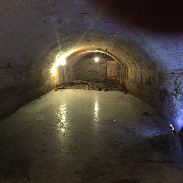
If you like beer and LiDAR (and who doesn’t?), boy do we have a story for you. The Cedar Rapids Gazette is reporting that the Iowa Society of the Archaeological Institute of America is scanning the beer caves below Iowa City. Their ultimate goal is to create a virtual reality experience of these historical spots and raise interest in historical preservation efforts.
What is a beer cave? You may know them as nothing more than that jazzed-up walk-in fridge your local convenience stores the larger cases of beer in. However, back in the mid 19th century, real caves for beer storage were still a vital part of the brewing process. Taking a cue from old-world brewing processes in Germany—where at least one of Iowa’s most prominent brewers came from—many American breweries before prohibition used beer caves for the cooling and aging barrels.
Not this kind of beer cave
Today, there are a number of caves around Iowa City, often right under heavily trafficked streets and busy parts of town.
On Monday, some workers lowered a LiDAR scanner 25 feet into the ground to perform a scan, reportedly making the cave the first in Iowa to be scanned.
Though a number of caves like this exist state-wide, their exact size and makeup is still unknown. “We don’t know exactly where this is under the streets,” said Adam Skibbe, GIS administrator for the UI Department of Geographical and Sustainability Sciences, while setting up LIDAR equipment 25 feet underground in one of the caves on Monday.
Unfortunately, the scans have not been released.
Edit: Adam Skibbe has commented that some early visualizations have been made available at the project’s official site. See the videos below.


