
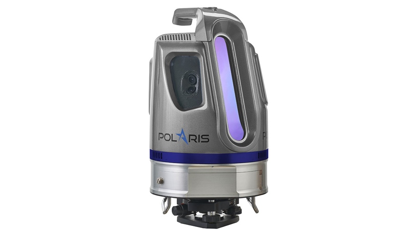
Teledyne Optech has announced the release of its new line of Polaris terrestrial LiDAR scanners. Optech says the three models in the range, the TLS-250, TLS-750, and TLS-1600, bridge the gap between small, lightweight short-range scanners and heavier long-range scanners.
The Polaris range was developed specifically for surveying use. The models come with internal cameras, inclinometers, compass, and GPS receivers. Polaris’ weather-proof housing is designed to allow use in a wide variety of environments and be mounted in any number of ways. That means you can mount it on a tripod, a vehicle, or any kind of moving terrestrial platform, like a train car.
All models have a 360° by 120° field of view, and include one-button surveying of pre-arranged plans for untrained surveyors.
The Three Models
The TLS-250 scans at the shortest distance of the three. It has a range of up to 250 meters and a laser repetition rate of 500 kHz. Optech says that this sensor is best for fast short-range verification and documentation applications.
The TLS-750 allows users to select from two data collection modes. One mode offers a 500 kHz scan rate and a range of 250 meters, like the TLS-250. The second mode adds a slower 200 kHz scan rate, which triples the sensor range to 750 meters. This model also includes options for external cameras and GPS.
The TLS-1600 offers three data collection modes. It includes the 500 kHz/250 meter mode and the 200 kHz/750 meter mode like the TLS-750. This top-of-the-line sensor adds a mode for a data collection rate of 50 kHz, which increases its range to 1600 meters. This model also includes the options for external cameras and GPS.
Teledyne Optech is showing the sensors at Intergeo 2016, and says deliveries will begin in quarter one of 2017.


