
Inspecting infrastructure assets like bridges and dams is crucial to their maintenance, but it’s easier said than done. Since these structures are large, complex, and often out of the way, traditional methods like terrestrial LiDAR can be slow, expensive, and difficult to use.
Romagna Acque, which is responsible for the drinking-water infrastructure in the Emilia-Romagna region of Italy, ran into this problem and solved it. The company needed a better way to inspect and maintain the backbone of their region’s aqueduct, the Ridracoli Dam. They found what they were looking for in UAVs and photogrammetry.
Using these technologies, the company was able to survey the dam at an accuracy that compares favorably to terrestrial LiDAR, but with greater coverage, at a much lower cost, and with much less effort.
And that enables them to do a lot more in terms of maintenance. Now that they can use UAVs and photogrammetry to survey the dam continuously, they are able to use preventative maintenance techniques and repair the dam before it breaks, saving money and lives in the process.
This is how they got there.
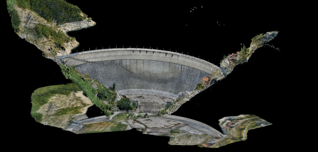
A dense point cloud of the dam
A Better Way to Maintain the Ridracoli Dam
The Ridracoli Dam has a basin covering 32 million cubic meters. The structure is 108 meters (355 feet) tall at the base and 440 meters (1444 feet) tall at the crest. It is comprised of 600,000 square meters (or 2 million feet) of concrete. It’s big.
The dam is also crucial to the drinking water of 48 municipalities, so Romagna Acque maintains it with very high safety standards. Because of this, the company has developed a model for predicting how the dam will respond to changes in environmental conditions, especially earthquakes and thermal variations. Knowing about a problem ahead of time means being able to prevent it.
There’s one catch: To feed this model, they need accurate data that can be gathered with short turnaround times. Romagna Acque thought that UAV photography would suit their needs in terms of speed, but they needed to be sure it fit the precision and accuracy requirements.
Does Drone Photogrammetry Make the Grade?
Working with Italdron, the University of Perugia, and the Department of Civil and Environmental Engineering, the company set up an experiment to try it out.
First they performed a topographical survey that they could use to validate the product of the UAV survey. With Total Station, GPS, terrestrial laser scanners, and aerial photography, they surveyed the main dam, as well as ancillary structures such as the guard house and the weighting blocks in the abutment.
Next, Romagna Acque set up their UAV survey. They planned the UAV flights for a single day to minimize the effect of atmospheric conditions (like lighting and weather) on the data. Before beginning the survey, they used Total Stations to place control points around the dam and surrounding area to geolocate the results of the UAV photogrammetry.
By sending the UAV out for 23 flights, each lasting about 25 minutes, they were able to gather upwards of 6,000 photographs. Some of these photographs were even taken in areas that were previously inaccessible for survey, like the downstream portion of the dam’s arch.
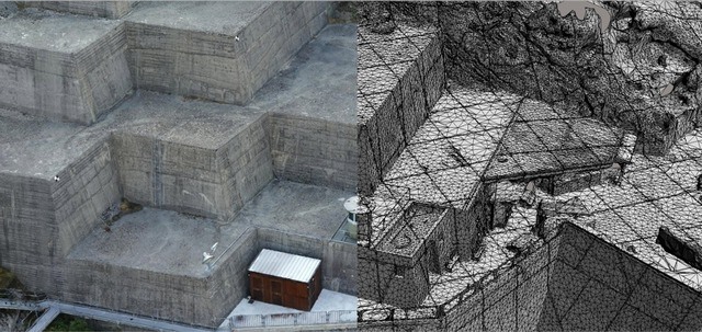
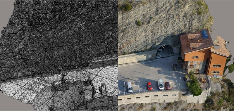
A 3D mesh of the dam produced by ContextCapture (the left side is colored and textured, the right side is raw)
The Model and the Moment of Truth
The group processed these photographs using Bentley’s ContextCapture photogrammetry software, which uses structure from motion (SfM) algorithms to automatically reconstruct the geometry of the dam. Bentley’s software generated both reality mesh files (3D models consisting of colorized and texturized polygons) and dense point clouds.
Romagna Acque and their partners checked the ContextCapture 3D mesh and dense point cloud by comparing them to the traditional survey data gathered with total station, GPS, laser scanners, and aerial survey.
The results? The UAV data exceeded their expectations, showing deviations within a range of 2 centimeters and sometimes even less than a centimeter.
Solving Problems Before They Become Problems
The dense point cloud generated by ContextCapture is a good reflection of the reality. It presents a fast and inexpensive means for seeing the current state of the dam. Properly calibrated using control points, it has even more power: The point cloud can feed Romagna Acque’s model that predicts changes in the dam’s mechanical properties over time.
By using UAVs and photogrammetry, Romagna Acque can now perform proactive asset management. They can apply tools and methodologies that detect trends and problems before they become real-world safety risks. The company can now plan appropriate action early on, with a full view to budget requirements.
In other words, they can solve problems before they become problems—and save a lot of lives and money in the process.


