

This month, Autodesk and Esri announced a new partnership at Autodesk University in Las Vegas. During the Autodesk Technology keynote the heads of both companies, Andrew Anagnost and Jack Dangermond, discussed details about the new alliance.
This new Autodesk/Esri partnership is intended to establish more tightly integrated BIM and GIS workflows. Both companies are now committed to the development of more seamless exchange of spatial and attribute data typically captured in Esri’s GIS systems and the information from 3D BIM models in Autodesk’s design software. The idea is to work together to create a more direct, bi-direction, and frictionless flow of information, enabling owners and AEC firms to work with more robust existing conditions models for planning and design, minimize data loss, and more effectively manage and operate infrastructure assets.
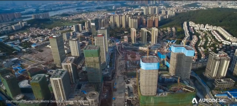
Although no specific initiatives or products have been mentioned at the announcement of the partnership, Anagnost and Dangermond discussed how both GIS and BIM can extend each other. Dangermond stated that cities all around will be faced with more challenges as a result of climate change, for example because of tropical storms. Combining architecture/construction design with digital mapping and analysis tools will enable communities to build more connected, resilient cities, and infrastructure with a focused eye on sustainability.

Who does it benefit?
More specifically, the people who will benefit from the alliance will be owner/operators, such as city and regional government planners and executives, and AEC firms who plan, design, and carry out capital projects for the owner/operators. GIS technology can provide a 3D context to what´s been planned, designed, and built, whether that context is a natural or built environment.
Why now?
It is anyone´s guess why the alliance was announced now, as there have been similar attempts for a BIM and GIS alliance in the past. But what´s different now is that it is the right moment for such an alliance, as it is aimed to make a stronger stand in the smart city space together. Governments and companies realize something has to be done to make cities more sustainable, using technology to create smart cities.
Technology maturity is also an important factor: For example, Esri has been working hard to make the transition from 2D to 3D GIS, and from desktop to web GIS. It is now better equipped to handle 3D technology, which will make integration with other 3D systems (such as BIM) easier. Common industry standards for 3D, BIM and geospatial data also help.

Esri has been hinting at integration of BIM in its own software and noticed a growing interest from Esri users to integrate both technologies. Over the last year, Esri has been working on integrating CAD and BIM into ArcGIS Desktop, and reading REVIT data directly into the application is in the works. Before this, BIM and CAD data had to be converted first through spatial ETL tools in order to work with them in a GIS environment.
GIS has moved also towards modeling in the 3D space. Recently, as a result of Esri´s Geodesign techniques and planning methodologies, the company developed a number of applications that combine landscape modeling and 3D GIS. This was seen as a step in a different direction, as GIS was always about analyzing and mapping what´s already there.
With this new Esri/Autodesk alliance, we´ll get to see more examples of these applications, but with a larger focus on cities. 3D models have become not only richer in detail, but also more performant and realistic. The moment when a city can be monitored as a model in real-time may be far away, but it something that will come one step closer as part of this alliance.


