

Esri has been introducing 3D capabilities throughout its ArcGIS platform over the last few years, but also took the initiative for a broader initiative, going back to 2015, introducing an open standard for sharing 3D content called Indexed 3D Scene layers (I3S). Last September, it was approved by the OGC membership, meaning it is now an OGC Community Standard for use by the entire 3D visualization community.
What is I3S?
The initialism I3S comes from (I)ndexed (3)D Scene (L)ayer. The Indexed 3D Scene (I3S) service and its sister format, the Scene Layer Package (.SLPK), are designed for the storage and visualization of “arbitrarily large” 3D datasets. I3S works as a web service and .SLPK is the corresponding file format.
A single I3S data set, referred to as a Scene Layer, is designed to be used in mobile, desktop, and server-based workflows and can be accessed over the web or as local files.
I3S is not a format, but a set of specifications that describe layer types and profiles that can be used to store and then stream a variety of content types. Scene Layers are based on JSON, REST and modern web standards. The Indexed 3D Scene Layer (I3S) and Scene Layer Package are now open formats and not dependent on any vendor-specific solution, technology, or products.
Why is the I3S important?
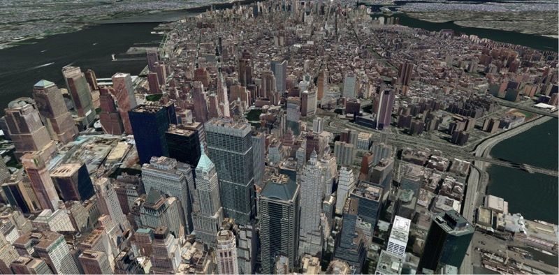
The I3S standard improves web, desktop and mobile performance of large 3D datasets by using spatial indexing for quick delivery. I3S data sets are also scalable: They are designed in such a way that an application will only request the resources it needs to visualize at the right level of detail. Requesting and displaying data over the web or a desktop will be smooth as it doesn´t load the entire dataset. A user never needs to request all the content until the application is ready to render it. This becomes clear when zooming in a large area, which will show more details only after zooming in further.
 What is supported by I3S?
I3S data supports different geometry types, such as:
- 3D Objects
- Integrated Meshes
- Point Features
- Point clouds
What applications currently support I3S?
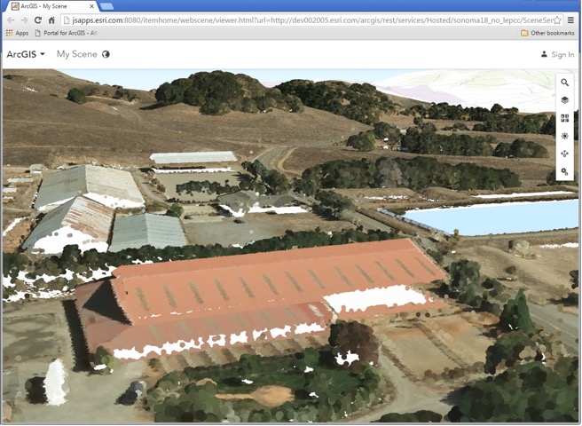
Various scene layer types that are currently supported by the ArcGIS platform. Depending on the application, they can be published as well as consumed. ArcGIS Online, ArcGIS Enterprise, ArcGIS Pro can publish and consume various Scene Layer Types ,whereas ArcGIS API for JavaScript, Esri CityEngine, ArcGIS Earth and ArcGIS Runtime can only do one of both. Apart from the ArcGIS Platform, Bentley Systems’ ContextCapture, Vricon and Pix4D also use I3S.
For more information, have a look at: https://github.com/esri/i3s-spec


