

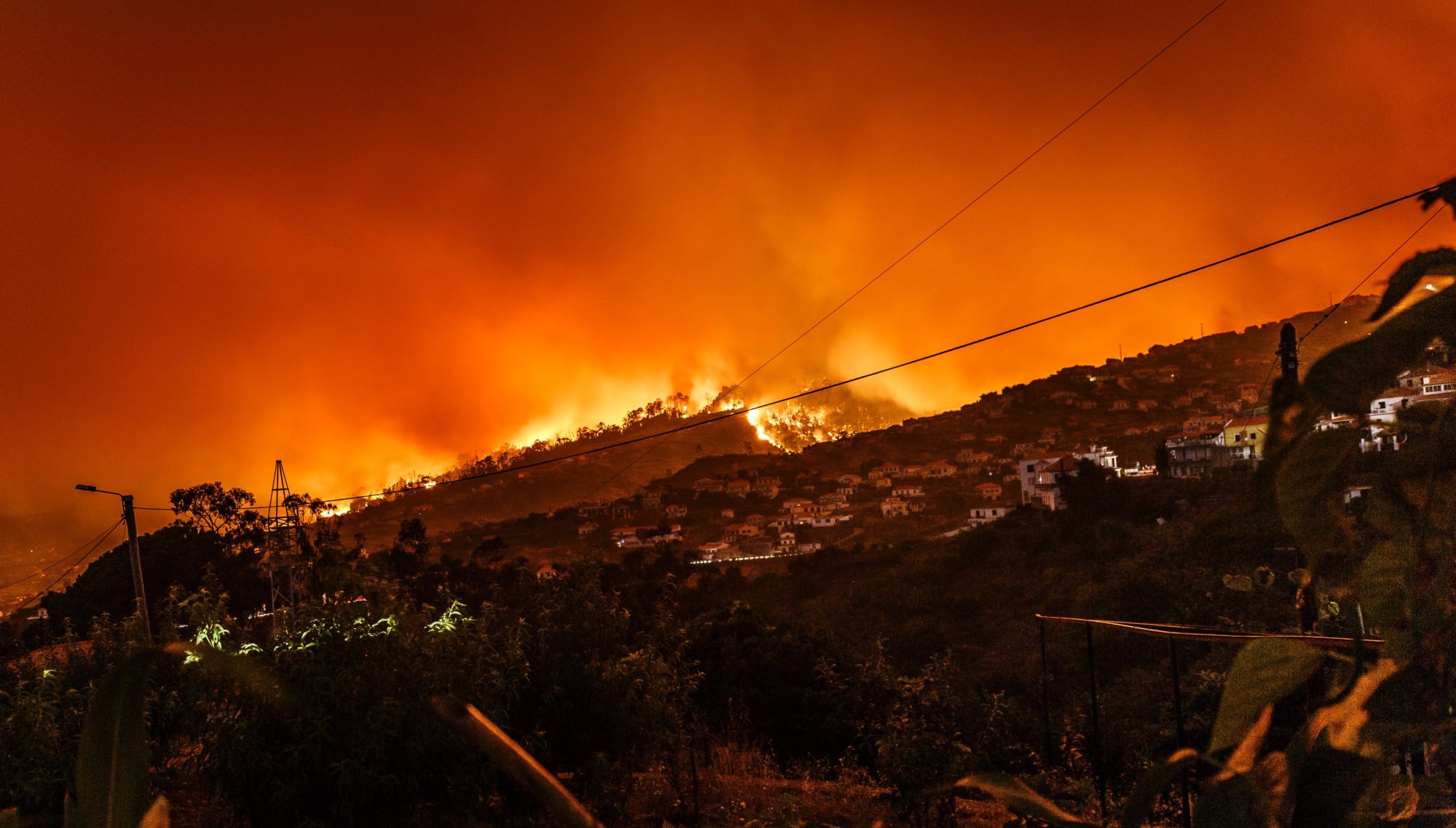
Record-breaking wildfires resulting in the loss of life and property have become the new normal. This year’s fires that raged across the western U.S. burned through over eight million acres—more than double the damage of last year. As climate change continues to worsen, the threat of catastrophic wildfires is only growing.
Combatting them effectively will require new protocols regarding prevention, preparation, and response. Today, decision makers are relying on outdated maps and data that leave communities vulnerable and first responders blind.
It’s critical that high-risk regions create and maintain living 3D models that provide real-time knowledge of risk, weather forecasts to predict ignition and spread days in advance, and ground truth so first responders can safely evacuate residents and contain growth.
Thankfully, the technology to do this successfully exists today. If first responders, technologists, and policy makers come together to implement tools to support this strategy, it’s possible to keep 2021 from being another record-setting fire year.
The complexity of wildfires: Many stakeholders, many challenges
Tackling wildfires is a complex, multidisciplinary endeavor involving many diverse stakeholders. They include firefighters, utilities, lawmakers, arborists, geospatial and data scientists, homeowners, and communities, all of whom must assemble and collaborate closely to implement effective solutions.
These events are unpredictable, and not all causes are preventable, so it’s impossible to eradicate them 100 percent. However, it is possible to work toward a solution that ends preventable wildfires, minimizes damage to communities, and eliminates fatalities. As the urban-wilderness interface continues to grow larger and become more populated, now is the time to make it happen.
AI-powered geospatial insights at the heart of a three-tiered approach
Central to any solution is a comprehensive and accurate view of the Earth’s land, features, weather, and infrastructure. Geospatial information can provide this digital view of the physical world and, when paired with artificial intelligence (AI), give stakeholders the informational edge they need to prevent, battle, and recover from wildfires.
There are three major components required to meet the goals above.
First, it’s essential to be proactive versus reactive. Stakeholders need to invest in tools and processes that predict and prevent ignition from the get-go. These solutions need to continuously monitor changing wildfire risk to stop preventable ignition events and better prepare and protect communities. Geospatial AI technologies fit this need with the ability to automatically build and continuously update high-resolution wildfire-risk maps in real time.
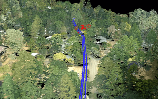
Living 3D models — utilities are able to see where vegetation is growing near power line equipment. (Enview)
Next, it’s important that solutions address every stage of the wildfire’s life cycle, from preparedness and prevention to response and recovery. 3D maps generated by geospatial AI work proactively to protect homes and communities by identifying where to create defensible space, and by letting utilities see where vegetation is growing near power line equipment to prevent contact ignition. Once a fire is ignited, living 3D models can be used to predict its growth trajectory and handle response accordingly. Geospatial AI can also automatically detect ignition in real time to give firefighters more notice and provide them with enhanced situational awareness in the field.
Lastly, the solution must generate specific boots-on-ground actions from state-size datasets. Wildfires are so large that they transcend towns and counties, demanding a statewide solution. Within these massive regions, localized actions need to be taken to save lives, protect homes, or prevent ignition. Geospatial AI technologies are capable of generating these granular insights from massive areas and datasets.
Although wildfires are here to stay, geospatial AI gives decision makers the power to greatly minimize, or even eliminate, preventable fires. For those that can’t be prevented, these tools give communities and first responders the urgently needed insights to handle the growing threat of catastrophic wildfires.
Guest post contributed by San Gunawardana, Co-Founder & CEO at Enview
San is the co-founder and CEO at Enview, a company creating living 3D models of our rapidly changing world. His background includes a PhD from Stanford on AI, embedding with the Army in Afghanistan, and aerospace at NASA and ICON Aircraft.


