
By Dustin Price, Operations Manager at Landpoint
In the past, large-scale surveys often required a surveyor to outsource much of the work, especially if the job needed to be done quickly. In these instances the work was commonly split, with parts of the survey going to other ground survey firms and, if necessary, manned aerial survey firms. This approach brings a number of difficulties.
However, it is quickly becoming unnecessary. With the FAA’s new Part 107 rule, it is possible for firms to utilize unmanned aerial vehicles (UAVs) to complete large-scale surveys without outsourcing some of the work. As a result, it is now easier for a single firm to survey a large area without potentially risking the quality of the deliverables.
Here’s why you should think about using UAVs instead of splitting up the work.
Multiple Ground Teams Cause Problems
Utilizing multiple crews is a tested solution for surveying larger projects, but it does create a number of challenges.
- Different surveying firms typically use different software, meaning data needs to be collected from these different platforms and compiled into one data set. This can sometimes lead to errors.
- Multiple teams working on the same project also means that there can be overlap, and even gaps in the work. This becomes even more of a problem when communication between the teams is poor or non-existent.
- Each survey firm has its own processes. When these different methodologies meet, it can result in inconsistent data.
UAVs allow a single survey firm to complete the survey alone, helping them to avoid errors, overlap, gaps, and inconsistent data.
UAVs Have Benefits Over Aerial Survey
Flying a UAV for a large survey provides a number of benefits over contracting out to an aerial survey firm.
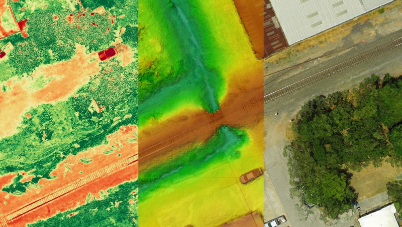
- UAVs are able to fly closer to the ground and capture more detailed scans, while still surveying large areas at once. Using a UAV, a surveyor does not have to manage both ground surveys and aerial surveys, meaning that information does not need to be translated or consolidated.
- UAVs provide consistent reporting, with data that can be instantly used and analyzed.
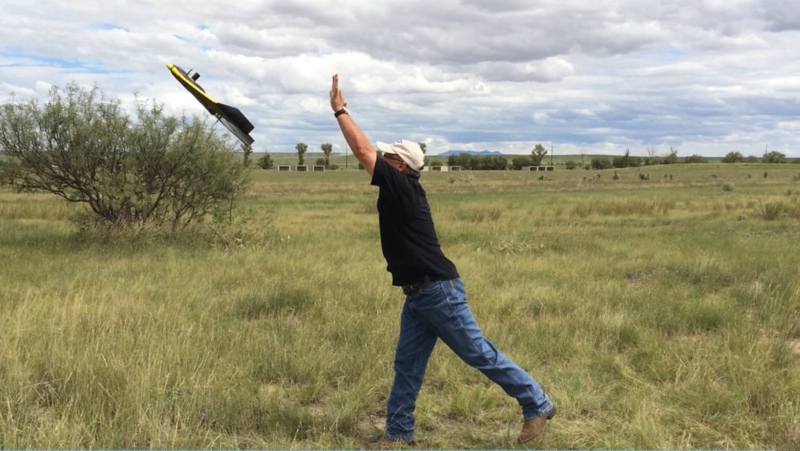
- Most land surveyors can acquire a UAV. Attaining Part 107 certification is relatively straightforward. Drones themselves are relatively inexpensive, meaning that the price of entry is low enough that most surveyors can take advantage of the technology.
- UAVs can be tailored specifically for the purposes of large-scale surveys—many are designed to capture data quickly over large areas in exactly the format that is needed.
- UAV surveys at this scale are both faster and more affordable because there are fewer concerns related to employees and safety.
- With UAVs, less has to be done to the high-resolution data that is collected, so fewer issues will arise.
- With UAVs the whole survey process—including the analysis process—will all be completed faster. This is critical because large-scale surveys are often done at the beginning of larger projects. A delay during a survey can delay the entirety of the project.
The New Challenge
As UAV technology proliferates, a substantial number of drone companies are expanding into the aerial surveying industry. But many of these companies are experts in UAV technology with only passing interests in aerial surveying. Though they may be more than capable in the areas of drone management and maintenance, they may not have the specific knowledge needed to create accurate and efficient surveys. This is especially true for large-scale surveys, which may have more crucial deadlines and protocols than smaller surveys. Companies that are able to blend expertise with both surveying and drone technology will be critical for these projects.
 Dustin Price is a licensed land surveyor and the operations manager at Landpoint. He leads the company in determining the technical approach for delivering professional, tailored surveying services through UAV technology.


