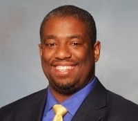
Shaheed Smith is a licensed Land Surveyor in Pennsylvania and Delaware, and principle at SAS Geospatial, LLC. He currently serves as the Vice President of the Pennsylvania Society of Land Surveyors Board of Directors and is chair of the Strategic Planning Committee. He is also an associate editor of xyHt magazine.

There have been countless advances in technology that has taken place over the years in the 3D laser scanning community. Some huge leaps, some small tweaks and we can expect much of the same in the upcoming years.
But as discussed in the media round table session moderated by SPAR’s Sean Higgins and paneled by industry media editors Gene Roe from Lidar news, Mike Anderson from POB and yours truly from xyHt here in Houston at Spar International, there may be something missing from the equation: Quality Control.
Don’t worry, it’s not to say that scanning firms are lacking QA/QC processes in their workflow, most of the companies that I encounter take good care to know that the information they deliver is as accuracy as possible. And that’s just it. Who is it across the industry that is determining how accurate to good enough? From an industry perspective, who should govern the determination as to what is accurate and what is not?
The conversation which was spawned from a member of the audience gained a lot of attention in the session regarding the quality of the data that is being collected and whether or not it is meeting the accuracy standard for the purposes intended. More importantly, does a surveyor play an integral role in checking scan measurements and certifying to its accuracy especially when it pertains to the building a construction industry?
In other words, in this still developing industry where mass data is captured and analyzed for many difference end users, should there be standards of accuracy which we should adhere to? It’s a good question–and one that deserves consideration. There are a lot of calculations happening in the background of these programs in the registration process, including error analysis and point adjustments, and if you are not intimately familiar with these mathematical process and adjustment concepts, it can make a huge difference in the accuracy of your resultant point cloud.
So it makes sense that a surveyor should be at the center of the scanning measurement process in some capacity since measuring distances, angles and heights are the focus of what the profession does. The problem then become whether or not the surveying professional as a whole is poised to take on the this massive task. Some think that surveyors are still in the process of transforming into scan users.
In the end, although the conversation was healthy and many of the concerns were valid, the feel was that hopefully this conversation would lead to more discussions and eventually as the technology progresses, perhaps our confidence in the accuracy that we achieve will follow.


