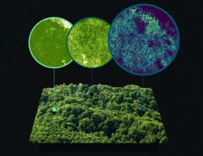
Growing up, I always had a fascination with maps. As a toddler, I still remember for essentially every meal I ate on a place mat with a map of the United States showing state capitals and major rivers. As I got older, my parents bought me countless atlases and other books with maps of different places around the world, which I’d spent hours reading and absorbing. Even beyond that, as the internet came to be, I’d kill periods of boredom by exploring random places on Google Maps, learning about uninhabited lands and dense city centers alike.
It will come as no surprise, then, that one of my favorite parts of this job covering the geospatial industry is getting to see so many interesting maps using GIS software and bringing in fascinating datasets. These maps range from crucially important, identifying areas and people of need, to trivially interesting, to visually stunning. For someone like me who loves looking at and studying these maps, last month on social media was a fun one.
November, for those unaware, is the time for the annual 30 Day Map Challenge, where social media users could share one map a day for the entire month, with each day having a different theme. You can see the list of the 30 themes here.
Below, I’m going to share my personal favorite I came across on LinkedIn for each day, but if this is something that truly interests you as well be sure to check out the offerings on other social media sites as well. (Note that LinkedIn doesn’t allow every post to be embedded, so some will be simply linked.)
Day 1: Points
We start off with a map of the United States playing off of the day’s theme, placing points in all places with the word “point” in its name.
Day 2: Lines
To me, the best instance of a line-based map shows navigation routes, and this is a fun one of all flights originating in the United States.
Day 3: Polygons
Here, we have a post that cannot be embedded but is a cool look at the most consumed starch in each country in 2021, with a twist of visualizing it with pictures of the starch filling the corresponding polygon.
Day 4: A bad map
The bad map theme is a tough one, but this is a good way of flipping conventional color schemes and show the importance norms play into interpreting visualizations.
Day 5: Analog map
Another one which cannot be embedded, but, well, how can you beat a map made of cake?
Day 6: Asia
This is both a fascinating look at the growth of India, and also just a visually stunning map.
Day 7: Navigation
Having just recently attended a conference centered around the commercial marine industry, this visualization is particularly striking to me right now.
Day 8: Africa
I’m always interested in looking at how civilizations settle across a land mass, and this is a compelling way of visualizing that data.
Day 9: Hexagons
Saving the bee population is crucial around the world, and this is a good way of visualizing the need, looking specifically at Ireland.
Day 10: North America
Combining GIS with data about lidar coverage is right up the alley of Geo Week News.
Day 11: Retro
Along with maps, I’ve also always been fascinated by mythical, ancient creatures, so this entry scratches both itches.
Day 12: South America
We haven’t had any bathymetric representation to this point, so this is a stunning view of one of the world’s most interesting areas.
Day 13: Choropleth
Here, we have a seemingly simple concept, but one that causes reflection on what exactly this says about demographic make up and different cultures.
Day 14: Europe
A fun concept for a map, and one that people could stare at for a long time and find many cool nuggets and insights.
Day 15: OpenStreetMap
Burlington, Vermont is one of my favorite cities in the US, so this was an easy inclusion for me.
Day 16: Oceania
Here we have a unique visualization of a fascinating concept which helps shape one of the world’s most interesting regions.
Day 17: Flow
Geo Week 2024 is just a couple of months away, so a map highlighting the Denver airport is a no-brainer for our inclusion!
Day 18: Atmosphere
This is a great visual while also highlighting an initiative that shows how global action can lead to positive results.
Day 19: 5 minute map
Alternative fuels follow the same global action theme, and this is a telling map made in a short time.
Day 20: Outdoors
As a lifetime resident of the Northeast in the United States, the Appalachian Trail is immediately what comes to mind for me when thinking of the outdoors.
Day 21: Raster
This is an interesting look at contrasts on Earth, which gets particularly interesting in areas with both fire and snow cover.
Day 22: North is not always up
The Spilhaus projection is my favorite concept in mapping, and one that always gets me to rethink my perception of how we look at the planet.
Day 23: 3D
With all of these maps focused on Earth, I found this to be a clever representation to look at other parts of the universe.
Day 24: Black & White
This is a fun twist on the concept, both following it literally and also taking the opportunity for a play on words.
Day 25: Antarctica
Frankly, this is just about the most visually stunning map I saw through the whole month.
Day 26: Minimal
I found this map to be a smart way to display a lot of global information in a minimal fashion.
Day 27: Dot
Similar to the above entry, this is a simplistic way to show a lot of crucial information.
Day 28: Is this a chart or a map?
There were a few options with this theme, but it’s a clever way to display charts in the form of a map.
Day 29: Population
As one would expect, most population maps focused on dense locations, so I enjoyed this look at the exact opposite perspective.
Day 30: “My favorite…”
It’s hard to pick a favorite of favorites, but this had key information and great visuals, so it wins my pick.