

Following from last week’s post about the state of the mobile mapping after ILMF 2017, I would like to discuss a point raised at the end of the ASPRS special session, “How Will Drone Mapping Impact the Lidar Market?”
The question, as asked by Lewis Graham, was: “Does the UAV industry really need a low-cost lidar system?” Here’s some context, and then an answer.
Does a low-cost technology mean the project will cost less?
Since a UAV platform costs a fraction of the amount needed to perform manned airborne operations, UAVs are helping many more firms enter the aerial survey industry.
As with any tool, though, UAVs need to meet the specifications required by the project. This is why assessment of “cost” needs to be realistic and complete. Licensing, mobilization, crew time, and data processing, for example, all have significant costs associated with them. These add up even when the cost of purchasing the UAV platform itself might have been relatively low.
I made my feelings known on this subject during a series on SPAR3D last summer. In short, a low cost technology does not always mean the work itself will cost less. Instead of focusing on the upfront cost of a technology, we should focus on the data-collection opportunities it enables—because that is where the real cost savings are.
How often is it appropriate to use UAV lidar?
The key is knowing whether what you are delivering is fit-for-purpose. Lidar should not be used just because it is perceived to provide better data, as (cheaper) photogrammetric methods might also provide data that is fit-for-purpose.
In my opinion, there three areas where UAV lidar is more likely to provide efficiencies to projects and create new opportunities. These include projects that involve:
- Linear corridors
Inherent direct-georeferencing workflows of lidar do not require the redundancy required in many UAV photogrammetric workflows. - Dense vegetation
Processing data to infer “ground” is more straightforward if using an appropriate lidar sensor. - Steep mountainous areas
Being able to reduce dependency upon ground control reduces risk on site.
While I am personally a proponent of lidar, the point that I am trying to make is that for many applications, photogrammetry is just as good. Even in the scenarios outlined above where lidar is likely to be better, it is not impossible to collect good data using photogrammetry.
Furthermore, there are many instances where photogrammetry is better. In my opinion, there is little reason why someone would use an UAV lidar system for measuring volume of a bare stockpile, as with no vegetation and a relative referencing system, a streamlined UAV photogrammetric workflow will provide a deliverable that meets requirements, and at a more competitive price.
Would a low-cost UAV lidar be the best of both worlds?
Lidar systems are sought-after tools due to the characteristics of data that they collect. The idea is, if they were less expensive, they could offer the best data for the lowest cost.
However, they are complex systems, and this not only applies to the laser scanning sensor itself, but also the inertial positioning technologies and software workflows required to collect and resolve the point cloud.
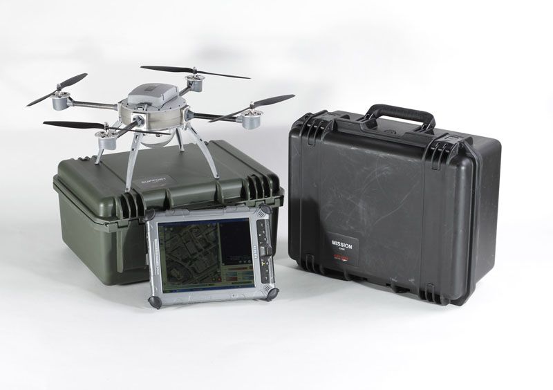
No tool is a magic-bullet, and again, as with any tool, the overall operating cost of even the most sophisticated systems needs to be accounted for. Often these costs are associated with understanding error in our projects. This was nicely illustrated in the ASPRS Special Session by Albert Iavarone of Teledyne Optech, in the context of a mobile mapping system at the high-end of the market, the Lynx Mobile Mapper.
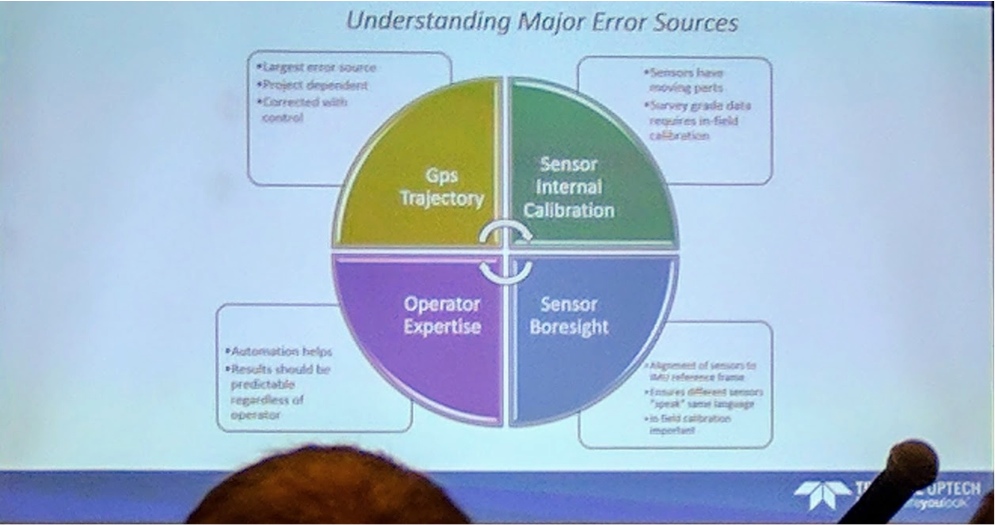
Teledyne Optech’s understanding of error in mobile mapping projects
If there are all of these sources of error and costly operational considerations associated with one of the “Rolls Royce” systems on the market, do you think these costs will go away with a lower cost solution?
Lastly, low-cost lidar sensors may not deliver the quality of data you think they will. Just because we call a low-cost sensor a “lidar” sensor, that does not necessarily mean it will collect data at a range accuracy, or a dense enough frequency, to meet the resolution requirements of many survey or engineering applications. Similarly, the lidar sensor might not be sophisticated enough to resolve return signals into the discrete return sequences that enable us to more reliably determine ground from various levels of vegetation in a scene. We are seeing some of these trade-offs already in some of the lower cost systems being used on UAV platforms today.
My argument is that, if you are applying UAV lidar to the projects where it will be of most use, it is likely to be in the survey-grade projects in the three application areas described in the previous section. What we might find with a system that has higher error margins, is that the cumulative operational cost associated with additional processing, or additional ground-control to make the data better fit specification, outweighs savings in the cost of the sensor.
In these scenarios, a photogrammetric system already has a head-start in terms of cost, and may still be just as good.
Is the UAV industry in desperate need of a low cost lidar system?
UAV survey and mapping methodologies are best when they enable us to collect data that we cannot collect currently. Reducing the cost of hardware to make UAV systems more affordable will itself require investment, and not necessarily address all costs and considerations.
Instead of asking how we can produce a low-cost lidar system, we should be asking how we can best deliver within the complete technical, operational and economic bounds of the current project.


