
It wasn’t all that long ago when intrepid explorers were still perishing in their attempts to find ancient cities hidden in South American jungles. Percy Fawcett, for example, disappeared in 1925 while searching for The Lost City of Z. Less than 100 years later, we’re mapping cities in minute detail—with greatly reduced risk of disease and disappearance—thanks to lidar. It’s giving our favorite technology another day in the sun.
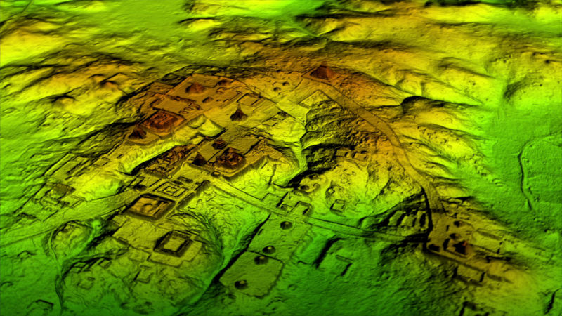
The recent flurry of attention lavished on lidar comes courtesy of a new paper published by Tulane University researchers in Science (a journal so prestigious they didn’t even bother giving it a fancy name). The researchers analyzed aerial lidar data for a 2,100 sq km area, isolating tens of thousands of human-made structures and hundreds of kilometers of terraces and causeways—virtually all of it undetectable to the naked eye.
The lidar scanning project previously made headlines back in February when the researchers announced preliminary findings.
Results indicate that the Maya city had a population of between 7 and 11 million people, which means it could have been significantly more populous than NYC and Mexico City. The scans also show evidence that the city was quite sophisticated, having performed extensive modification to the land in order to build infrastructure.
Looks like autonomous vehicles aren’t the only lidar use case that gets the public in a lather.
To dig in deeper on the details—and see some pretty pictures—here’s a link to the original paper and some of the more noteworthy coverage from around the net.


