
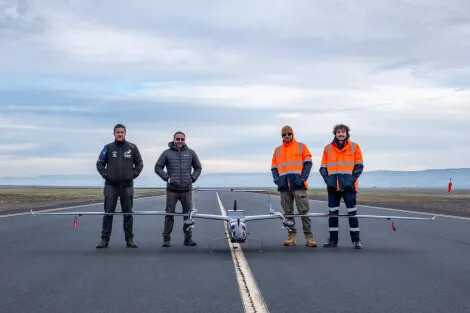
Carbonix announced a significant milestone in aerial surveying and data acquisition of linear assets with the collaboration between RIEGL Australia and Phase One.
The three companies have successfully joined forces and flown the RIEGL VUX-12023 and Phase One iXM 100 medium format camera on Carbonix’s fixed-wing Ottano X. The combination of these highly sophisticated pieces of equipment is used in the field of remote sensing and geospatial data collection, serving critical use cases across the linear infrastructure and mining sectors.
“The partnership with RIEGL and Phase One puts Carbonix at the forefront of remote sensing technology, empowering critical sectors with multi-modal information crucial for decision-making, planning, and monitoring,” said Philip van der Burg, Carbonix CEO. “By harnessing the synergy between LiDAR’s precise 3D data, and photographic imaging’s detailed surface, colour, and texture information, we can provide a holistic solution that enables users to see enhanced details about their asset, assess environmental conditions, and create digital twins with unprecedented accuracy. This collaboration underscores our commitment to innovation and customer satisfaction, as we continue to push boundaries and shape the future of geospatial data collection and analysis.”
The capability of this combined sensing platform has been proven in Australia and the US, covering more than 12,000 hectares in a single mission. Being able to capture detailed large scale colorized 3D models of the infrastructure and terrain is a game-changing result of this combined technology in commercial operations.
“This collaboration is a big step forward for how we gather data from the sky, bringing us closer to a future where aerial surveys can be done with less risk to operational personnel, greater mobility and increased frequency,” said Glenne Blyth, RIEGL Australia Managing Director.
“This project and collaboration between technology leaders proves that there is a path forward for how the collection of images and LiDAR data using drones can be scaled to even the largest areas,” said Michael Messerschmidt, Director of Product Management, Unmanned at Phase One. “In an accelerated and dynamic world, scalability is the key to keeping the digital world up to speed with the rapid changes in the real world.”
As the first in the industry to accommodate and operate multiple survey-grade, high-resolution sensors concurrently, the Carbonix platform paired with RIEGL LiDAR technology, and Phase One camera will enable users with a multitude of benefits including:
- High-Density Data: The platform offers superior resolution and colorization, enabling the capture of high-density data crucial for precise analysis and insights.
- Operational Efficiency: With the ability to deploy multiple sensors in a single flight, this maximises operational velocity and efficiency by streamlining data collection processes.
- Extended Endurance: Extended flight durations resulting in substantial cost reductions of up to 80% compared to both multi-rotor and manned aviation alternatives.
- Vast Coverage: With a scanning capacity of more than 12,000 hectares or a linear distance coverage of up to 400 km per single mission, this integration enables comprehensive area mapping at an unprecedented scale.


