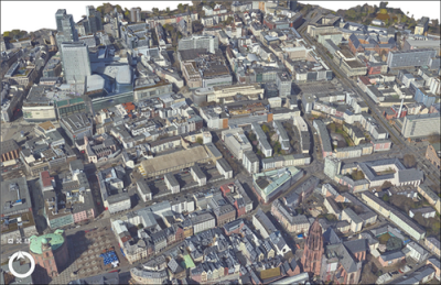
Geospatial data provider UP42 provides many different data types and formats. As a company, ensuring data compatibility and interoperability proved to be quite challenging to extract insights from different datasets. The same goes for users, who until now needed to download data assets as compressed ZIP files and decompress it before processing all of them, with the possibility of running into different naming conventions or inconsistencies among data formats.
Providing data interoperability and discoverability
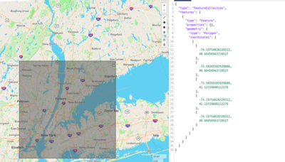
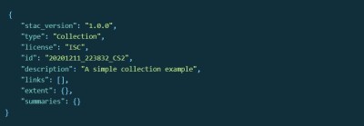
This changed when UP42 adopted the STAC standard, which is short for SpatioTemporal Asset Catalog and provides a universal standard and common language to describe geospatial information. After its introduction in 2021, the standard has been adopted by different providers of remote sensing and spatiotemporal data. STAC items are GeoJSON file features representing a collection of inseparable data and metadata, that can be crawled or browsed. The standard solves the problem of disparate data formats and types, while at the same time making it easy to see what a dataset contains. As such, it provides interoperability and discoverability of spatial data to users.
UP42 adopted the STAC standard in 2022 for searching and ordering geospatial data. This meant that users could search across multiple providers for data with a common structure and set of metadata. In April of this year, the company announced that the standard was adopted for stored user data as well, bringing consistency to the entire platform. In a blog post, the company described the lessons learned from this process.
A new cloud-native asset model
The most recent announcement from UP42 concerns the introduction of a cloud-native asset model for assets stored in UP42’s storage. By transforming assets in a standard model, consistency is guaranteed for an asset’s media type, role and name. All raster data is translated to cloud-optimized GeoTIFFs (COGs), while vector masks are converted to GeoJSON files. A cloud-optimized GeoTIFF is a regular GeoTIFF file, hosted on an HTTP server, enabling fully cloud-based geospatial workflows as it has been optimized for efficient storage, access, and processing in the cloud.
The data transformation process to COGs is applied to the majority of UP42’s current catalog and tasking data, which includes geospatial data from Airbus, Intermap’s NEXTMap, Capella Space, BlackSky, Satellogic, and more. After transforming the data, it will be exposed through STAC, meaning it is accessible and streamed. This means that it is no longer necessary for users to download datasets. The cloud-native asset model also enables easier integrations for analytic workflows, visualization, and custom platform integrations.
The process of STAC collections and items when a tasking or catalog order delivery is made available in UP42 storage happens automatically, so there is no extra effort required from a user. Delivery files are listed as STAC assets, while raster data is translated to COGs and vector masks to GeoJSONs. UP42’s online API documentation provides more information on the STAC specification and terminology. In the future, UP42 plans to introduce cloud tools and cloud-native formats to enable more efficient and centralized data management.