

Searching for a “go anywhere” 3D mapping system, not dependent upon a GPS system to work? Say hello to GeoSLAM HUB, which enables users to process data from a Standard REVO system create more and diverse outputs with it, such as a colored point cloud.
The system’s HUB Viewer allows users to view data and add notes to the point cloud, Views can be shared, too—for free, through the GeoSLAM Viewer, a free viewer application.
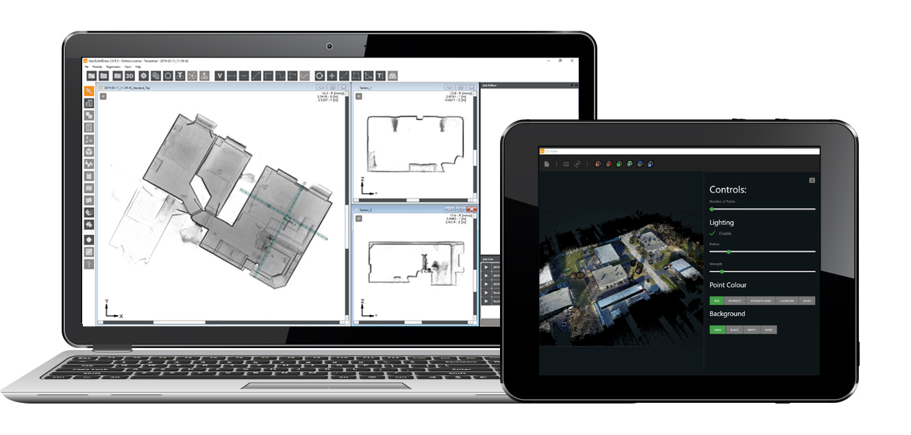
Released in 2018, the HUB is just one of the company’s recent offerings. The recent introduction of sector modules with the software’s Draw application also has changed things with the company and for its customers, too.

Shelley Copsey
With the regularity of this company’s upgrades, it seems innovation is a byword at GeoSLAM. SPAR 3D recently touched base with GeoSLAM CEO Shelley Copsey, to talk about how the company is revolutionizing the architecture engineering and construction industry, why Digital Twins matter in nearly every sector, and more.
How is your company’s technology revolutionizing the AEC industry?
Copsey: “In their most basic state, our hand-held devices have revolutionized the AEC industry since their inception in 2012. GeoSLAM technology has opened new opportunities for this industry – it has helped to reduce time and cost consumption through efficiency, eliminate health and safety risks, as well as build accuracy and sustainability for regeneration projects in particular.
“GeoSLAM technology has the ability to ensure developers meet deadlines, both in terms of project timelines and indeed, cost. Often fundamental to a project’s success is ensuring its multiple stakeholders (including designers, architects and construction workers) are well informed with a build’s progress, highlighting any issues, particularly in its early stages.
“GeoSLAM technology has enabled cooperation between multiple stakeholders to become a more streamlined process – with developments often involving hundreds of subcontractors. Its simple-to-operate method, portability and end-to-end solution has helped improved productivity, driven down costs and improved communication between all parties.
“Surveyors, for example, may have once spent several days recording building measurements using total stations or tape measures, but advances in our technology have meant that all information relating to an asset can now be contained and updated in a single digital environment, which all stakeholders have access to.
“Our most recent innovation is the ZEB PANO, a device developed for the property and real estate sectors. It offers property professionals the ability to capture floorplans and hi-res photography simultaneously, a first of its kind. With time constraints a regular challenge for stakeholders in the property industry, the ZEB PANO will help to improve the process of generating building images, giving operators the accurate property dimensions in rapid time.”
How much of the use of your technology is related to digital twins, and not in construction?
Copsey: “Many sectors benefit from GeoSLAM technology, and digital twins can be generated for a multitude of those sectors – from forestry and mining, to security and stockpile management. We have a lot of interest from those managing warehousing facilities that need point in time asset usage statistics.
“Every day we’re talking to businesses who see endless use cases for the ZEB family of products, and with advancements in sensor synchronization the possibilities will only increase.”
Why are GeoSLAM’s tools and processes better for the user?
Copsey: “GeoSLAM is the global market leader in ‘go-anywhere’ 3D mobile mapping and monitoring technology. Its pioneering and adaptable technology, has been adopted by a range of sectors, from engineering and mining, to forestry and facilities and asset management, showcasing its versatility as a product designed for anyone.
“From our device’s easy to use walk-and-scan method of data collection, to an ability to rapidly scan large buildings and spaces, GeoSLAM technology is saving both time and money for its operators spread across multiple industries. Our latest innovations include developing the first ever airborne laser scanner that doesn’t require an additional GNSS/IMU unit, saving significant amounts of weight and cutting costs for surveying teams – the ZEB HORIZON’s unique technology, designed by our team of experts, enables the possibility of autonomous navigation including automatic obstacle avoidance.
“GeoSLAM’s SLAM algorithm is the strongest on the market, it’s the only one that can perform in mixed environments, in all weathers / lighting conditions, and doesn’t need to be kept exactly level.
How has the introduction of your sector modules with Draw changed the game in terms of your firm’s offerings?
Copsey: “In our latest upgrade, the team at GeoSLAM have created several new additions of the GeoSLAM Hub 5.2, including packages that provide specific features to suit a range of different industries and projects. The Draw Start module, now standard for every operator, allows clients to create simple floor plans and georeference data quickly and easily.
“Additionally, with its check-in, check-out licensing, users can publish and share their work from the office and field while remotely collaborating on the datasets with co-workers all over the world. We have had a lot of demand for our solutions and we are ensuring that our software design meets the needs of both small and large companies.”
Why were these modules devised – was it due to customer requests?
Copsey: “User experience was at the very heart of Hub 5.2’s development. The upgrade now allows all customers of the ZEB family – both new and existing – to access the latest features with universal compatibility.
“The introduction of sector modules within Draw is recognition of the importance of well-designed digital workflows specific to our customers’ applications. GeoSLAM Hub was already the go-to software for processing and visualizing geospatial data, and now Draw makes gives our customers greater flexibility.”
Do you have a regular beta test crew of clients who try out products, to help improve your process?
Copsey: “To ensure we release new solutions as quickly as possible we work with a number of our dealers and enterprise customers to both contribute to feature design and test new software releases before general release. The feedback from our dealers and users is instrumental in the future development of GeoSLAM solutions.”
Aren’t the same sorts of processes covered through your technology also offered through apps that can be downloaded on a phone?
Copsey: “With today’s mobile technology reaching into every corner of our lives, it is not difficult to imagine that our phones are capable of producing scanned images akin to GeoSLAM technology. The biggest drawback to this mobile technology is limitations in accuracy. However, utilizing mobile phone technology as part of a workflow is important because of convenience and cost saving; our ZEB REVO RT system can be used with a phone or tablet to see, in real time the area that has been mapped in relation to a floorplan.”
Can you illustrate how your tech is a time-saver?
Copsey: “We recently begun working with an architecture firm, PARAGRAM, who had been tasked with the regeneration of the tallest skyscraper in Belo Horizonte, Brazil. At 130 meters high and stretching 32 floors, the 1940s building required time-consuming work to retrofit electrical installations and fire prevention plans.
“Putting aside traditional methods of scanning, which would have taken multiple days to scan the entire structure – and with which it would have been difficult to capture many features, like those in roof cavities, GeoSLAM’s ZEB-REVO device was called upon.
“Regeneration projects are often governed by strict time constraints, however with the device and its ability to rapidly scan large areas, it took just two participants under 10 hours to complete an entire scan of the building’s interior, with one walking through the building holding the device and another taking a photographic record of the 8,357 square meter building.
“This innovative way of working meant the PARAGRAM team were able to gather much more information than first anticipated, including the registration of beams and roof trusses, electrical installations and engine room area – a game changer for regeneration projects. This can be used again and again during the project, providing efficient snapshots of the progress of the project and changes being made to the building.”
What’s next for your company – more integration with other tech tools?
Copsey: “Integration is central to our strategy, as shown with the launch of Hub 5.2. The next 12 months will see exciting developments including: expanding our global team – we have customers across the world and we are building out our sales team to have more of our people in core markets; continuing to deliver solutions that meet the needs of customers in a broad range of industries – expect to see Draw get even better; and innovation – we are the world’s leading go anywhere 3D mobile mapping and monitoring company and we plan to bring new product to market that will see us continue to hold this position.”


