
Simultaneous localization and mapping (SLAM) technology helps robots navigate indoor environments, but there’s always room for mapping miscalculations. With a new software, NavVis thinks it’s possible to significantly reduce these problems.
The Navvis M3 Trolley exploits SLAM to increase speed and efficiency when scanning buildings. It is capable of producing 360° images, point clouds, floorplans, and infrastructure data. The mobile 3D scanning device uses six high resolution cameras to capture 360 degree panoramic images, as well as three high-definition laser scanners that record up to 40,000 points per second within a 30 m range. Additionally, NavVis’ browser-based IndoorViewer software brings this data to life by enabling users to access and interact with 3D building models and maps from any device.
As with most SLAM solutions, this software for capturing and chaining highly accurate individual measurements results in “an accumulation of noise and tiny measurement uncertainties.”
“Over time,” the company says, “the estimated motion will start to deviate from the true motion, which is known as “drift error.” This can often be observed as a slight bending of long corridors that are actually straight.” With NavVis newest Precision SLAM technology, the company has significantly reduced drift error and improved the SLAM accuracy.
“I am very excited about our new Precision SLAM technology,” said Dr. Stefan Romberg, head of mapping and perception at NavVis. “It is widely known among SLAM developers and users that complementary approaches such as loop closures or ground control points are needed to achieve a high accuracy. However, with the Precision SLAM technology we have developed an approach that not only nicely complements the former techniques but is especially evident when these have little effect or cannot be used.”
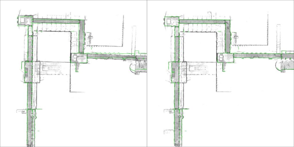
The images below demonstrate the impact of NavVis Precision SLAM technology. The left image depicts a long corridor mapped with a conventional SLAM system where the above-mentioned drift error has occurred. The green outline shows how the map deviates from the true structure. The image on the right shows the significantly improved map accuracy obtained when mapping the same area using the M3 Trolley with the new Precision SLAM technology.