
Today at SPAR 3D 2016, Autodesk announced a significant overhaul of their ReCap 360 product line.
Where previously the ReCap portfolio included a number of products, now Autodesk has simplified it to two. The company offers only the free version, ReCap 360; and the Pro version, ReCap 360 Pro. What’s more, the Pro version of the software features a dramatically low price: $300 per year as compared to last year’s price of $2000 per year.
As Marketing Director for the the Reality Solution Group Dominique Pouliquen explained to SPAR 3D, the reasoning for this big change is that Autodesk’s “value proposition has always been ease-of-use and the democratization of laser scanning and the UAV workflow.” The lower pricing will also make ReCap 360 Pro an ideal entry point for Autodesk’s software ecosystem, as well as a platform for accessing Autodesk’s new and growing set of data processing services.
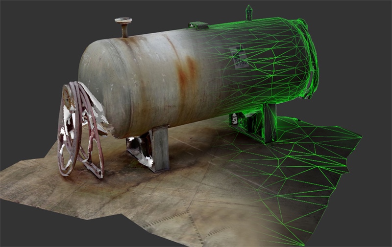
Scan-to-mesh processing
The big new data service is a scan-to-mesh service that allows you to select an object within your point cloud to convert to a watertight, textured 3D mesh file. Pouliquen explained that this process works in a manner similar to the photogrammetry processing in ReCap 360.
Customers pay with cloud credits for each object that they send to the cloud processing to be converted into a mesh. When the mesh is finished, they receive an email alert.
This scan-to-mesh service is still in beta, but will have a number of interesting uses when it’s available. By way of example, Pouliquen said that customers could use it as part of a retrofit process. Simply scan the existing assets, have them turned into mesh files, and then use those meshes when populating the new layout. However, there are limits: Autodesk limits each use of the service to 20-25 scans, or an asset of roughly a few cubic meters.
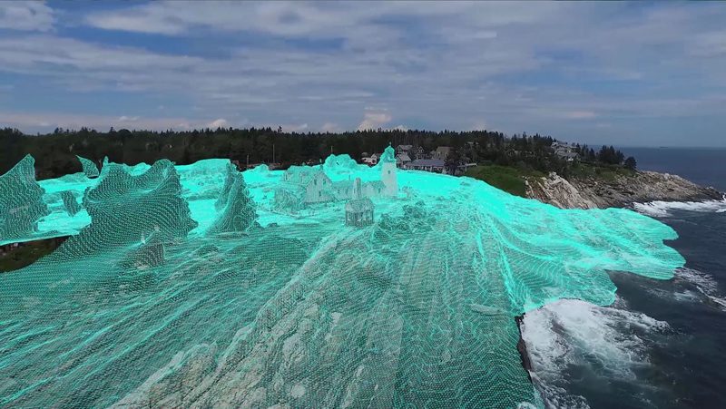
Existing data services, like the Fly service for converting UAV photos, have also been upgraded. They generate improved ortho views, and have been tweaked for better integration of photo-based and laser-based point clouds.
Improved registration of photo-based and laser-based scans
“We tried to push hard on this one,” Pouliquen said. “There are a lot of use cases when you want to merge photo-based point cloud on a laser-based point cloud. The photo-based point cloud would be used to append your point cloud with what you can’t access with laser scans, like the rooftop.”
He also noted that UAV workflows often present an easier way for collecting data, as well as an excellent way for gathering the context of a site by capturing everything that is beyond the laser scanner’s line of sight.
Other data services offered in ReCap 360 Pro include an auto-cleanup too that removes noise from scanned data, and a batch project creation tool. For more information, stop by Autodesk’s booth at SPAR 3D Expo and Conference 2016.


