

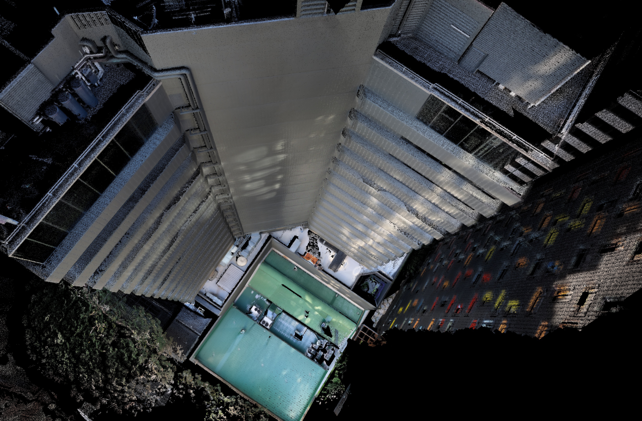
Hovermap is the flagship product of Emesent, an Australian drone, lidar and data analytics company. It consists of a mobile scanning unit with SLAM-based mapping that is intended to be mounted on a drone to provide autonomous mapping (but can also be used as a handheld device). This update, announced today, brings true color augmentation to point clouds, providing additional context for visualization.
The new colorization uses a GoPro Hero8 camera, which is designed to withstand the challenging conditions in which it might be used. The modular approach extends the flexibility of the Hovermap systems, and customers can choose to attach the camera when the colored scans are needed, or omit the camera when it is less important (to save weight or extend battery range).
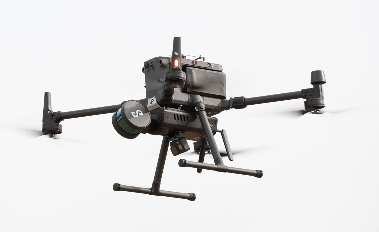
- The GoPro action camera can be simply attached to the Hovermap scanning unit which can be used on a drone, as a hand-held or backpack mounted scanner.
For Emesent’s CEO and co-founder, Stefan Hrabar, this feature is significant.
“Colourisation provides greater insights for our customers across many industries. This builds on the incredible 3D data that Hovermap produces to create rich, accurate digital twins and surveys.”
Hovermap with the camera attached can be used as before – either on a drone, as a hand-held or backpack mounted scanner with the supplied handle or other accessories. Hovermap and the camera are started with the push of a button, and after capture the lidar and video data are processed via a “drag-and-drop” workflow. For advanced users, a vast range of parameters are also made available to further adjust processing and output options.
In addition to producing a colorized point cloud, the process will output a set of images and image pose data (position and orientation relative to the point cloud). This allows the lidar data and images to be imported into a variety of third-party tools to be shown side-by-side.
The new functionality required changes to the algorithms being used to ensure that the different data inputs lined up, says Dr. Farid Kendoul, CTO and Co-founder of Emesent.
“Combining camera and LiDAR data from a moving scanner is actually a very challenging task which requires precise calibration and synchronization between the two sensors. We’ve developed advanced algorithms to handle this complexity, keeping it simple and easy for our customers to use. The results are really amazing to see.”


