
During the HxGN 2018 conference, it became very clear that Leica Geosystems wants to have a 3D capture device that suits almost any use case you can think of. “There’s an overarching reality capture strategy,” says Juergen Mayer, business director of terrestrial scanning at Leica Geosystems. “I think, today, we took a big step forward in filling some of the empty spots.”
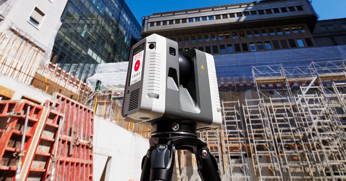
The new Leica scanner he is telling me about, the RTC360, fills in the gap between the traditional P-series scanners and last year’s much-discussed BLK360.
The RTC360 completes a full-dome scan in under two minutes, while capturing 2 million points per second. It scans from 0.5 m out to 130 m, with accuracy of 1.9 mm at 10 m, 2.9 mm at 20 m, and 5.3 mm at 40 m. During each scan, it captures full HDR imagery with a 36 MP 3-camera system. It includes a touch screen, as well as a GNSS, altimeter, compass, and IMU.
Who is it for?
Mayer explains that the RTC360 is not designed for absolute beginners in the 3D space, nor is it designed for professional surveyors. So who is it for?
“I think it will be pretty attractive for people who know about 3D point clouds, who have the need for 3D reality capture, and 3D models, but are not necessarily doing the scanning themselves now,” he says. “So that means people in building construction, for example in a BIM context. Big construction firms would be interested in using this kind of equipment for progressive scanning of construction sites. Or public safety.”
Of course, that’s not to say users of Leica’s other scanners won’t find something to like here. BLK360 users will likely see the RTC360 as a step up in the Leica ecosystem, since it offers better specs and physical hardiness, while retaining the same ease of use. Mayer also notes that the system could offer a nice complement to P-series users, who might bring out their long-range scanners to capture the outside of a building, and then use the portable RTC for interior short-range scanning.
VIS: real-time point-cloud registration in the field
Because Leica Geosystems has designed the RTC360 for people who use 3D data but have not yet taken the steps to capture the data themselves, the company has taken pains to make the workflow as simple as possible.
As a result, the scanner includes a new technology Leica is calling VIS (visual inertial system) that performs automatic point cloud alignment in the field, with no input from the user. Basically, it uses the 3D coordinates of features—like the edges of a door, the floor, or a window—to track your position as you move within a room, between rooms, or even between floors.
But that approach alone would still leave the problem of compounding positioning errors over the course of the scan, so Leica pulls in data from all the other sensors as well. The simplest way to explain it, says Mayer, “is we use the cameras to stabilize the IMU—we are giving eyes to the IMU so it can check out the drift. It is unlike purely IMU-based solutions, which give you approximate positions, but not very good ones, because of the drift.”
The VIS works independently of GPS signals, as you would expect, but it also allows users to scan without holding the scanner in a specific way, or putting it on a dolly. “You can just pick it up,” says Mayer, “and walk around without thinking about what’s happening in the background.” Clearly, someone at Leica has been working on this for quite some time.
A holistic solution for an easy workflow
With the attention the scanner has received since its announcement yesterday, it could be easy to overlook that the RTC360 was conceived, designed, and built as a holistic system that includes field software and office software. Here’s how it all works together.
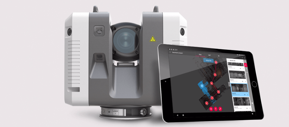
When you scan in the field, the RTC360 scanner creates what Leica calls “lightweight objects” from the data, which it sends to the tablet for review in a matter of a few seconds. Once the data is on the table, you can use the field software to review it using a bubble-type view or a 3D view.
Next, simply move the scanner to the second position, and the scanner will track your location. When you perform a second scan, the scanner sends the data to the tablet, and it comes up already located in the correct position. Mayer says you can check this real-time registration with a quick cloud-to-cloud if you like. Keep doing this for as many setups as you need to complete the job, and the system will continue to link your scans automatically.
This is all synchronized back to the RTC360 scanner, which records your data on a USB stick alongside any transformation data, photographs, or other important information. Remove the stick, plug it into your computer, and Cyclone will load the lightweight objects for an instant preview. Here you’ll have another opportunity to correct for missing links or other errors. Last, you hit the import button and the system takes care of the rest.
“The whole goal,” says Mayer, “was to take the pain out of the registration process. That’s why it needed a system approach—because you have to have all the components under control. I think the RTC360 will be very attractive for a wider user group who was probably a bit held back from the complications of registration.”


