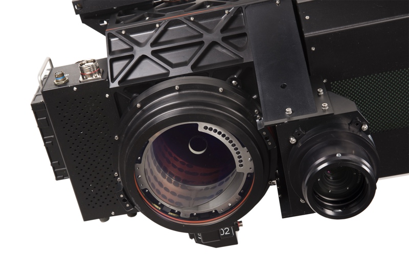
During ILMF 2017, Leica Geosystems released the SPL100 single-photon scanner as part of the RealTerrain solution. RealTerrain bundles the sensor together with the HxMap data processing solution to enable the efficient gathering and processing of large-area data lidar data sets.
The SPL100 sensor is Leica Geosystems’ first single-photon sensor, and the first sensor to be released using SigmaSpace’s technology since the company was acquired by Hexagon last year.
As a single-photon sensor, it is part of the next generation of aerial lidar sensors, promising up to 6 million points per second, with up to 30 points per square meter density, and intensity information. It offers vertical accuracy under 10 cm, and horizontal accuracy under 15 cm. The SPL100 also includes an 80 MP camera for collecting RGBN color data.
Leica says the sensor offers the lowest cost per data point for state and country-wide collects, and up to 10 times the efficiency of the company’s previous aerial offerings.
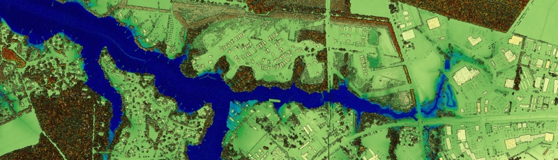
HxMap, Leica’s post-processing software for multi-sensor workflows has been updated to accommodate single-photon data collects. It offers a single interface for processing SPL100 data and generating end data products, and Leica says the software is fully scalable across multiple machines, upgradable, and modular.
Details
For a deeper dive into the SPL100, the HxMap solution, and how customers can access the RealTerrain solution, I caught up with Ron Roth, product manager for airborne terrestrial lidar at Leica, at ILMF. Watch below.