
Response to user demand: ‘Help us deal with this large volume of data we’re starting to accumulate’
VANCOUVER—Safe Software reports it has incorporated support for point cloud data in FME 2011, the company’s spatial data transformation platform.
After doing a 10-city blitz of user meetings last spring, Safe co-founder Dale Lutz said, “the overwhelming message we got was the number one thing they needed was, ‘Help us deal with this large volume of point cloud data that we’re starting to accumulate.” And this was coming from asset owners and municipalities as well as engineering firms and surveyors.
Since this had been something Safe had been batting around for a few years, said Lutz, ‘We said, ‘Okay, it’s time to do that.’” The company surveyed a number of its users and developed the functionality that debuts in FME 2011.
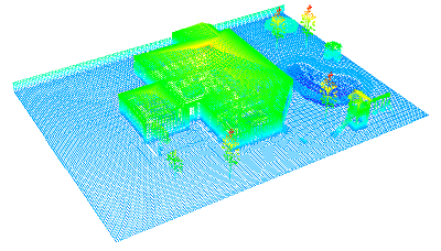
“This is really what I consider bread-and-butter data management for point clouds,” he said. “We can translate into Pointools, read ASCII files, and we can also re-project a point cloud from one coordinate system to another. Plus, we can tile, take big point clouds and cut them into little pieces.” Users can also filter point clouds using certain parameters.
Here’s a 10-minute video with Lutz running through the point cloud functionality:
Perhaps the most important thing to come out of this, said Lutz, “is that by adding point clouds into FME, the data integration options for point clouds are blown wide open.” Now, you’ll be able to integrate data of different types with point cloud data to draw new conclusions and present new deliverables.
For an example of some of the scenarios that customers have asked Safe to solve, check out Dmitri’s Point Cloud Lab, where those scenarios are addressed in step-by-step fashion.
“That’s where I’m most interested,” said Lutz, in how this point cloud data can be used and applied. “Customers will do modifications of point clouds using vector data,” he said by way of example. “If they have footprints of buildings, they’ll go and remove everything that’s in the building footprint. If they know where there are bodies of water, they’ll go and flatten that part out and tinker with the point cloud that way.”
As for the future of data standardization in 3D imaging, so that there will be less need for converting point clouds from one format to another, Lutz said this industry is already at a pretty good point. He noted that LAS is a file format that many in the aerial LIDAR industry have already embraced, and he said that ASTM’s E57 standard is something Safe is looking at closely.
“Practically no users are asking about that,” he said, “it’s mostly vendors right now, but that (ASTM E57) could be a player if you’re looking at 18 months into the future.”


