
Hi-CAD Limited, Dingwall, Scotland, is one of the world’s most experienced providers of dimensional control services for offshore and onshore process facilities. Last month we looked at what’s driving investment in Hi-CAD’s services and how the company got its start. This week we explore how Hi-CAD has expanded its arsenal of dimensional control competencies, and where laser scanning fits in.
Total stations to photogrammetry to laser scanning
What led Hi-CAD to expand from offshore into other markets? “A milestone was in 1997 when we were taken to America by Amoco,” says operations director Dave Penman. “We had done work for Amoco in the UK. They saw the benefits of our process, so they took us to their Whiting refinery in Indiana. Then we migrated to Texas, where we have an office today.”
This was when Hi-CAD first moved beyond total stations to other digital tools for existing-conditions capture. D.I.M.E.S. used with total stations is “very high-accuracy, but low-volume,” Penman explains. “To capture a lot of information, it was too slow. That’s one reason we then went to close-range photogrammetry in conjunction with D.I.M.E.S., to have a tool to capture high volume as well as high accuracy. We got into photogrammetry in mid-2000, using the Vexcel solution.”
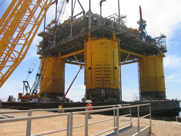
Is Hi-CAD still using photogrammetry now that it’s brought in laser scanning? “Yes, we’re still using it,” says Penman. “Sometimes photogrammetry is still the best option, for example if you’re working in an environment that’s very unstable. Because the camera takes a picture in hundredths of a second, you don’t have to have the stability” that laser scanning requires. “We’ve done some jobs where the platform was a work boat. The photograph takes hundredths of a second, so it’s not affected by the movement of swells.”
Photogrammetry is also well suited to working in congested or constricted environments. “With laser scanning,” Mackie notes, “the difficult part is trying to get the laser scanner up to a position it can look down from – trying to get a good viewpoint.” Penman explains that using photogrammetry, “We’ve done some work offshore where we’re actually working in the substructure, where there’s very little walkway. It’s all stairways, small access-ways – very poor conditions for getting a laser scanner set up. We’ve done complete plants with close-range photogrammetry.”
When is laser scanning the right solution? “What killed photogrammetry years ago was the cost and delay of developing the data,” Penman says. “Laser scanning gives you a 3D deliverable almost straightaway. So for an offshore job where we can get stability, we’re going to use laser scanning. But if there are highly vibrating conditions or very tight access, that’s a job for photogrammetry.”


