

Last month at the Geospatial Summit in London, an agreement was struck between two governments to share knowledge and technology crucial to construction projects in urban centers. Viscount Camrose, the UK Minister for Intellectual Property, and Kinga Surma, the Government of Ontario Minister for Infrastructure, signed a Memorandum of Understanding (MoU) to share knowledge and technology behind the National Underground Asset Register (NUAR).
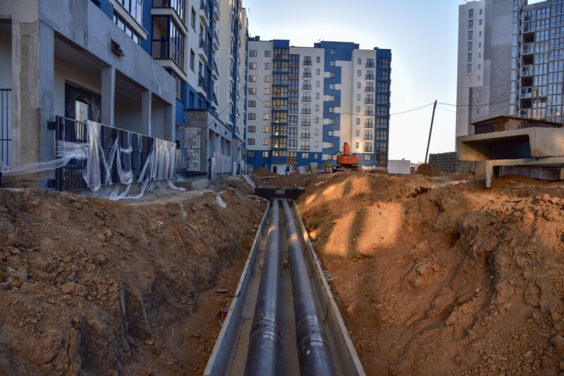
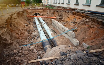
Originally announced in the form of a pilot phase in April of 2019, NUAR is a digital map of underground pipes and cables that will eventually cover the whole of the United Kingdom, and which the UK government claims will “revolutionize the way we install, maintain, operate, and repair the infrastructure buried beneath our feet.”
In April of last year, the UK’s Geospatial Commission released a “minimal viable product,” or MVP, of the register for parts of England and Wales, with an update coming towards the end of the year covering the entirety of England and Wales. To create the digital map, asset owners are able to share their data into a single location, and the Commission will standardize said data to make it readable for everyone. They have also ensured that data will be secured and protected against misuse. Ultimately, they believe NUAR will result in £490 million per year in savings from improved efficiency, reduced asset strikes, and reduced disruptions for the public and local businesses.
Both the UK and Ontario – the most populous province in Canada by a significant margin – are dealing with some similar problems that NUAR can help address, specifically around aging infrastructure and housing crises. The solution to each of these issues revolve around new construction involving digging, and in urban areas that means contending with underground assets that may be improperly mapped, or not mapped at all.
In the announcement of this MoU, they say that this agreement “paves the way for the Geospatial Commission to share best practice and technology from NUAR with Infrastructure Ontario and the parties will collaborate to improve worker safety, reduce asset strikes and improve the accuracy of geospatial infrastructure data - using UK technology and knowledge to support Canadian infrastructure.”
At Geo Week we’ve covered how dangerous these underground strikes can be, and how important it is to have accurate data around the location of these assets. In fact, just today we published a series of articles we’ve written in recent years covering this space.
The short version is that, particularly in older areas like the UK and the eastern portions of the US and Canada, workers rely on records from when assets were originally buried. It goes without saying that these were not created with digital tools, and oftentimes they are based on design plans rather than actual locations of buried assets. As a result, workers often unintentionally strike these assets, leading to dangerous situations, costly repairs, shut downs of local areas, and delays on projects.
There are criticisms around NUAR, including the fact that it’s unclear whether all digging companies or just asset owners and their supply chain as well as questions around KPIs, but it’s clear that something like this is needed. Urbanization means digging in areas that are already populated and already contain dangerous underground assets. This poses danger to both workers and the local public without clear information about where these assets are located.
“I am delighted that the Ontario government has recognised the excellent work that that has been done in the UK by the Geospatial Commission in developing the National Underground Asset Register, and the significant value that the work could bring to Ontario’s infrastructure and economy,” said Viscount Camrose in a statement. “This agreement both strengthens the longstanding UK and Ontario relationship and shows the strength of the geospatial sector in the UK.”
Kinga Surma added, “The Ontario and UK governments have always been great partners, including sharing our collective knowledge and experience in the infrastructure sector. With this agreement, we will continue to learn from and collaborate with the Geospatial Commission, so that we can speed-up the delivery of key infrastructure projects in Ontario. I look forward to strengthening this partnership, as our governments explore and implement innovative solutions that support the modern infrastructure needs of our growing communities.”


