

For many working in the environmental, energy or natural resources fields, spreadsheets are the go-to tool for project management, and also a source of frustration and error. Between the cumbersome collection of cells, data can be lost, mistranslated, duplicated, or siloed away from the users that need it most. For managers, keeping track of individual locations this way can add layers of unneeded complexity. For Vincent Lam, CEO and co-founder of Matidor Technologies, this problem was something he felt compelled to solve.
“After working in those fields and talking to a lot of users – the recurring theme is that there’s no easy way to manage all the data you want to share, and they’re using too many systems.”
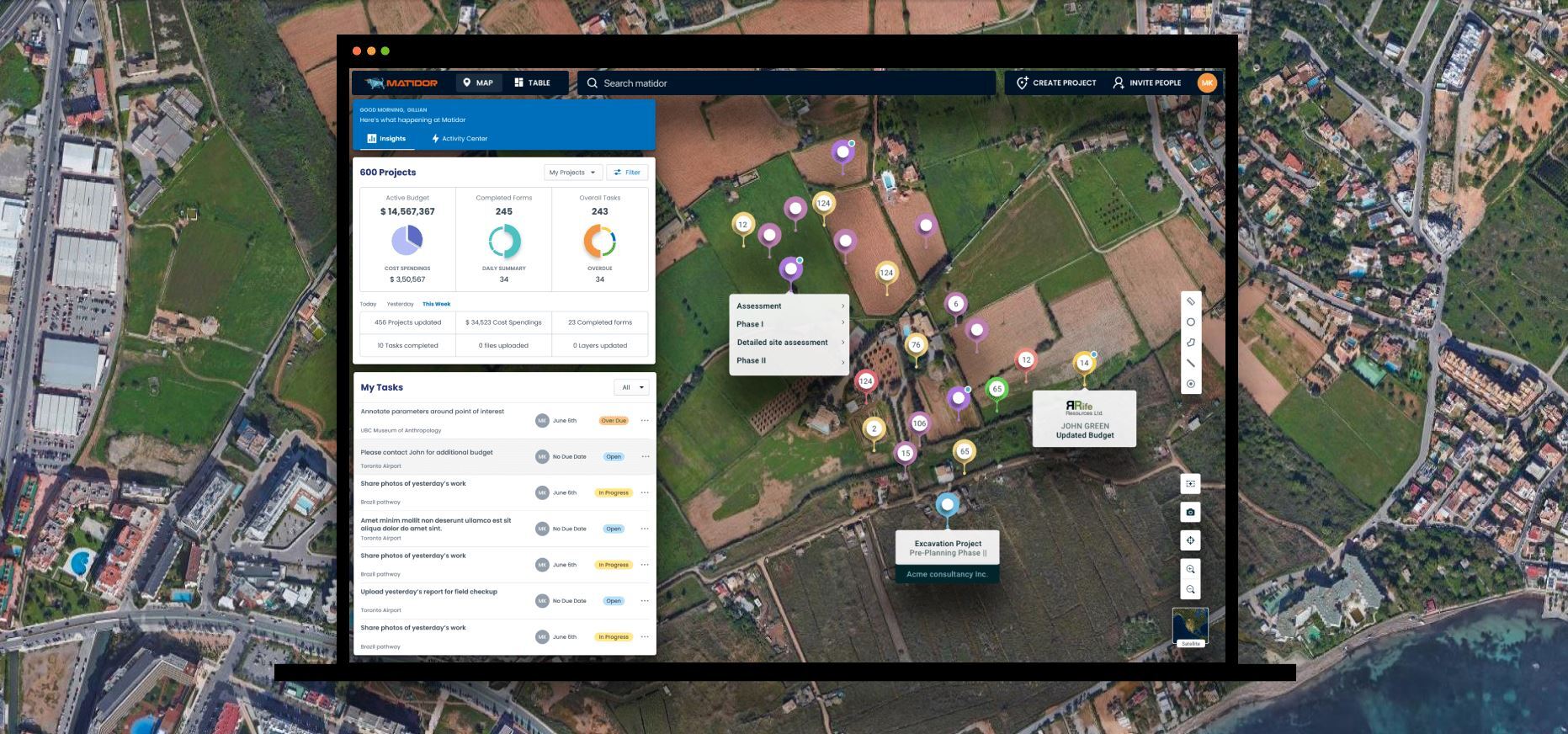
The solution was to create Matidor.com, a geospatially-focused project management platform that helps to unify and simplify the management of data, both internally and with external customers and stakeholders.
Harmonizing location data and project management
Built on an intuitive map-based interface, Matidor.com delivers real-time updates and acts as a mechanism for collaboration and reporting among users. Matidor.com can provide both a broad look at a company’s entire portfolio – for example, all of the locations where project work is occurring, or different locations of plants, farms or other sites – but also zoom in to any single location to track progress and documentation from tasks related to that site.

It is one thing to be able to place pins on a map – but it is another to provide a solution that encapsulates project information, allows for annotation, and can be integrated into systems that may already be in place. The data Matidor.com can handle includes the highly technical, such as ArcGIS and AutoCAD, and also the more enterprise operational tools such as Deltek and Quickbook systems. Matidor aims to bring both the GIS data and the operational data into one single platform, says Lam.
“In many cases companies have their own GIS teams and systems in place, but those are not designed for project management, usually they are not what is shared with clients. In those cases we integrate with the existing systems instead of replacing the entire suite, so the GIS team can still supply the key information into Matidor and then share the project management information with their clients.”
Matidor was launched as a solution aimed to eliminate some of these barriers, but also to create a bridge between technical information and external stakeholders. By ingesting information within an intuitive and user-focused interface, everyone can get on the same page more quickly, says Lam.
“Companies have been working in silos, and even within the teams, that has caused a lot of inefficiency – one team doesn’t know that the other team is working in the same area, and those are the ways time is wasted, where information is not being shared.”
Working with existing systems
Matidor.com is industry agnostic but is best suited for companies who have teams that are dealing with project and geospatial data regularly and need to communicate and collaborate more effectively.
“We’ve been working with a lot of oil and gas producers – their issues are that they have too many consultants and vendors that they are managing, and everyone is providing different things – so Matidor helps them to organize all these separate updates and information.”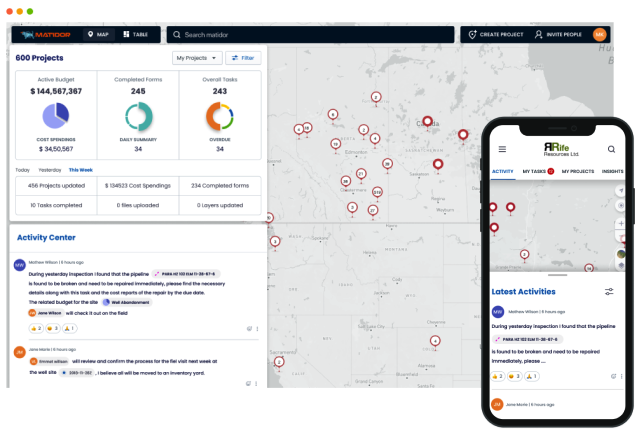 When clients work with Matidor, there is an onboarding process that takes an average of two weeks, that involves a consultation and information-gathering phase. By assessing what systems (and spreadsheets) are being used, Matidor can apply different project templates and fields to parallel what was previously used. The data from the old systems are then imported into Matidor based on the template and setup, and then a 1-hour training and orientation is scheduled, sometimes with clients or stakeholders joining in at the same time, says Lam.
“The platform is pretty intuitive already, so they will likely be able to start learning by themselves, but we use the training to show them shortcuts and get them to understand the new processes they will be using. Companies tend to invite external parties to discuss how they are going to be working together in the future.”
Having a platform where teams can collaborate together with the support of GIS and project management tools makes geospatial-based work much less frustrating to manage. Getting the right data into the right person’s hands, and clearly communicating tasks, updates, and location-based information within one system can enable collaboration while leaving the frustration of project management behind.
If you’d like to learn more about Matidor.com, you can request a product demonstration now.


