Big, intense wildfires are a normal occurrence now, says National Geographic. So what do we do about it?
Drones offer one part of the solution, because they can perform tasks that would be too dangerous for human workers. They can gather mapping data regularly, for instance, to track the movement of a fire.
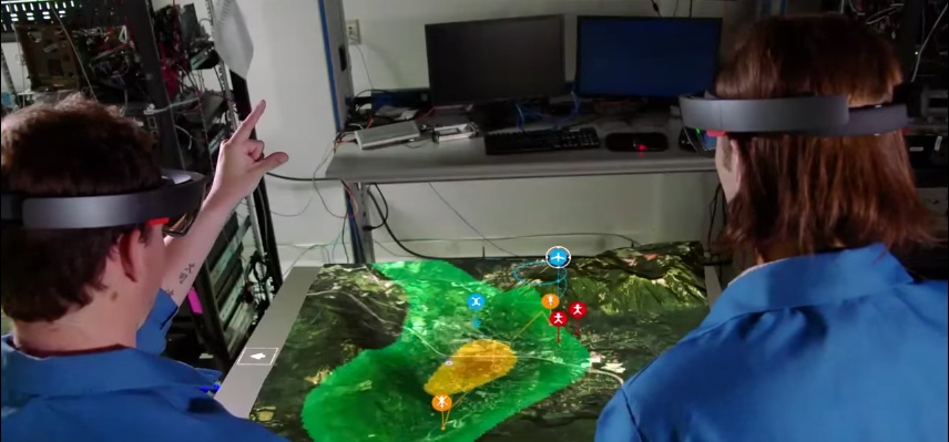
Boeing’s Insitu division takes it a step further, by using that data to generate 3D models that they pipe into a HoloLens. This futuristic mission control tool shows all the manned and unmanned aircraft as well as the teams on the ground.
When a team is operating with limited resources (and what team isn’t?), there’s a lot of value to putting all the necessary data in the same place and allowing anyone to access it. This ensures that decisions about allocating time, money, or other resources are made quickly and confidently.
You’ve heard it said before, but there’s no replacement for a single source of truth.