With all the hubbub last week about Leica’s release of a Cyclone app designed to complement the BLK360, it may have escaped your notice that Leica also announced a TruView Cloud product.
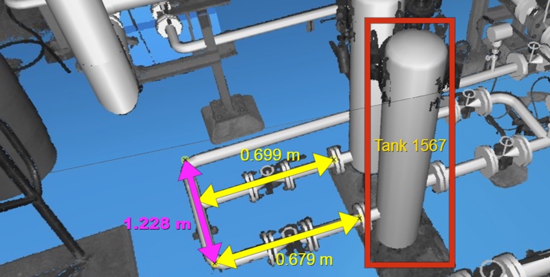
TruView Cloud Service is designed to be an easy, powerful, and reliable platform for sharing reality project data. Users can take data gathered by any kind of sensor and—simply by logging into a Cyclone Cloud account—publish it for remote access and use in BIM, GIS, and CAD applications.
Though TruView Cloud is designed to offer a very simple upload operation, it also includes much more granular security controls, enabling administrators to set permissions and restrict data access as necessary for different stakeholder communities. From there, stakeholders can use the TruView Cloud Service to view, measure, and manipulate digital reality data “anywhere, anytime, and on any device.”
As Faheem Khan, vice-president of business development explains, the service will be managed by the same team that manages Cyclone Cloud. This helps “free up scanning professionals from the complex IT demands to maintain highly available cloud servers and services,” including personnel and maintenance. Furthermore, Khan says that customers can pay only for the services and consumption they need—which should help lessen the cost of sharing information.
Leica promises that TruView Cloud will enable users to “access the same enterprise-level project collaboration solution [as a local TruView server]in a Leica Geosystems-trusted and managed cloud environment.”