2023 was a big year for the geospatial industry. Consider these highlights:
- New university centers for geospatial studies were announced at Yale University and Montana State University.
- Innovative products (like a first-person laser scanner from Hexagon) were unveiled at Intergeo a few months ago.
- Danti, a natural language processing startup, built a search engine for geospatial data that raised $2.75 million in pre-seed funding.
Building on the momentum the industry found in 2023, it’s feasible that 2024 will prove to be an even bigger year for the geospatial segment.
As we round out 2023 and head into the holidays, looking forward to what may be in store for the new year for the geospatial industry can help you start the new year on the right foot, empowered to plan and execute on 2024 roadmaps.
Here are my five 2024 predictions that geospatial specialists may find helpful:
1. Generative Design and Artificial Intelligence
Flashy headlines about generative AI have dominated news cycles this year since the launch of ChatGPT at the end of 2022, and Google’s Bard, launched back in March of this year.
In the architecture, engineering, and construction segments, generative design has emerged in years past to allow designers to automate design logic, finetune design parameters, and deliver a myriad of solutions at scale that push the bounds of what’s humanly possible in the hands of one person or team. Companies like Siemens have added generative design to their offerings in additive manufacturing, while PTC has introduced this technology to their CAD product, Creo. Autodesk is empowering customers in segments as wide-ranging as automotive to aerospace to industrial machinery—and yes, architecture, construction, and building products.

Scholarly research has already begun to understand how BIM and generative design can be used concurrently to automate fire safety engineering. Within the geospatial segment, research has looked into the use of neural networks to generate “suggestive site planning […] for morphological analysis for city’s urban fabric” as well as having potential applications to the real estate segment and in the hands of urban designers. Such a tool, the researchers explain, could be used to facilitate “fast-prototyping design iterations at the very early stage of a real state financing project that involves complex site planning.”
Certainly, with the surge of activity by artificial intelligence developers and companies across industries rolling out AI products and features, we’re quickly approaching a point of mass adoption. As we enter 2024, it’s likely more opportunities to fit AI (as well as generative AI) into a geospatial workflow will present themselves. IBM has already advanced geospatial AI to help fight climate change; its geospatial models have helped reforestation and water sustainability efforts in Kenya, for example, helping “track tree planting activities, aiding local efforts in restoring forests and measuring carbon sequestration impact.”
Pairing geospatial data and generative AI and large language models (LLMs), meanwhile, can help “simplify geospatial intelligence.” It can help create an “interactive geovisualization of billions of points” and facilitate the processing and generation of “entirely new data, encompassing maps, images, and text, all based on existing data sets.” The result, in turn, is a dramatic streamlining of the “process of analyzing geospatial data, uncovering hidden insights that were once obscured,” Kinetica tells Geospatial World. Amazon’s Bedrock platform, too, uses generative AI to automate geospatial tasks via autonomous agents and through an easy-to-use API that is able to route data from third parties like Esri, HERE, Grab, and OpenStreetMap.
And while these new breakthroughs show great promise, it goes without saying that any technology has its risks, and business owners should know those and how to address them, too.
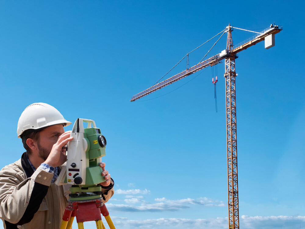
2. Increased Demand of Geospatial Specialists in Infrastructure Projects
The Biden Administration has put significant resources into sustainable infrastructure initiatives and infrastructure grants to help empower environmental imperatives, create clean energy jobs, and lay the groundwork to address climate change through a clean power grid, large investment in public railroads, EV charging infrastructure, electric school buses, and more.
As these infrastructure projects take flight, it’s fair to predict there will be an increased demand for geospatial specialists to visualize and manage geographic data and connect construction data to intuitive maps.
Consider what Robin Hargis, 3D Manager for Maxar Technologies, told career accelerator Rung for Women:
“Where a city needs more infrastructure (power/water) is determined by geospatial. Geospatial information helps result in better information to create a model of prediction for disaster relief, and address maintenance for 911 and other emergency databases. Zoning and school districts, vegetation and terrain analysis for planning, and determining how diseases will spread through communities and factors that contribute to that—this all requires geospatial data and/or analysis.”
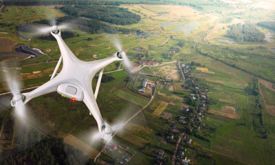
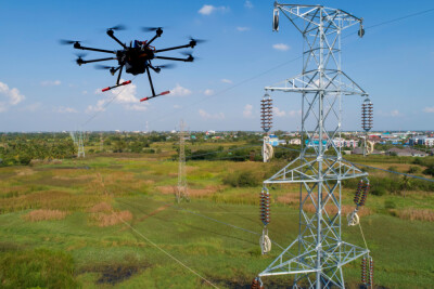
3. Continued Demand on IoT and Cloud-based Systems
Location analytics through IoT sensors can help facilitate anything from tracking tools on projects to processing, analyzing, and visualizing real-time GIS data.
As the above-mentioned infrastructure projects take flight, there’s an increased need for real-time collection and monitoring of project data, conceivable through the integration of the Internet of Things. Scholarly research into the application of smart IoT devices in GIS settings examined the efficacy of such an integration, demonstrating promise for driving efficiency in projects with “real-time data collection and monitoring along with the capability of GIS to deal with geospatial data and attributes [, which] makes it a suitable choice for addressing many challenges.” Additional research showed the design of an IoT-GIS platform performing automated analytical tasks.
Integrating IoT and GIS can help provide:
- Real-time positioning (Connected vehicles, soil moisture monitoring feeds, smart electricity meters)
- Real-time spatial analytics
- Big data analytics
4. Continued Use of BIM in Projects with AR/VR Integration

A study by Dodge Data & Analytics (via ForConstructionPros) pointed to BIM as the key ingredient to the AEC industry’s shift to digital. Builders continually turn to BIM to improve quality assurance, client satisfaction, and ensuing cost savings courtesy of rework mitigation.
With major breakthroughs in AR/VR via product launches like Microsoft’s market trailblazer Halo Lens, Meta’s Quest 3, and the recent launch of Apple’s revolutionary Vision Pro, it’s possible more companies will apply AR/VR to BIM in order to help their GIS specialists and planners experience 360-degree panoramic VR experiences in which they can collaborate and perform their work with greater accuracy.
5. Data Synchronization to Remain an Industry-Wide Focus
I’ve previously written about the importance of interoperability and how technologists can move the needle in the right direction.
As the industry combats labor shortages, integration has been a prevailing topic and industry-wide focus—consider, for example, how 77% of construction businesses in Southeast Asia reported they are committed to data integrations in operations. It’s likely this trend will continue worldwide.
- Integration with GIS and BIM can help build smart cities with greater efficiency.
- Integration of BIM and asset management can help share important project data between design and onsite execution team as well as sending tool usage data from smart tools that can be used to build reports that verify installations were performed to specification.
- Ersi shows how integrating GIS data and AI have helped companies like FedEx improve supply chain efficiency and real-time reporting, and helped companies like Microsoft and AT&T monitor global change to fight climate change.
Final Word
2023 was a big year for the AEC industry as well as the geospatial segment specifically. As we move into 2024, it’s probable that geospatial specialists will continue to be in demand as infrastructure and clean energy initiatives will require precise geographic data and mapping.
Equipped with emerging technologies like generative AI and maturing technologies like BIM and AR/VR, geospatial specialists will be empowered to work more efficiently and achieve greater project outcomes than we’ve seen in prior decades.