

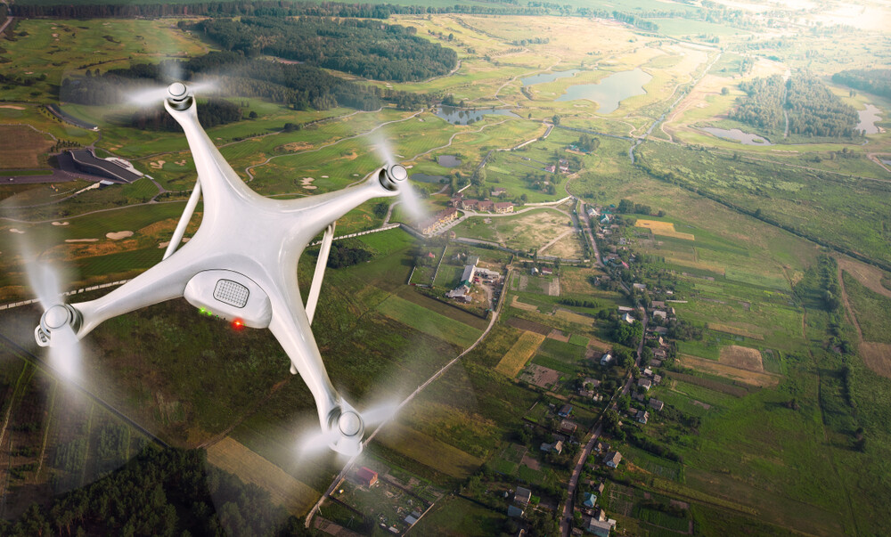
Geospatial information has always been crucial to humanity’s survival, going back to the first maps, and moving forward to the Age of Exploration in the 15th, 16th, and 17th centuries. In modern times, we’ve generally taken this data for granted, but that has changed in recent years. There are many examples of how things are changing, but between apps like Uber and DoorDash, among many others, that rely on location, and emerging opportunities like mixed reality and the broader “metaverse,” commercial opportunities are more overtly leaning on this data, pushing it further into the public consciousness.
That, of course, is just the commercial aspect of the technology. While there is a lot of financial gain to be made from geospatial knowledge, this data can also be used for the greater good, something else that has come to the forefront in recent years. In fact, this topic of geospatial technology being used for the good of society and the planet is going to be the topic of Monday’s keynote at Geo Week 2024, as highlighted earlier this month.
The benefits of this technology is certainly not something lost on the younger generation of geospatial professionals, a group who is already doing incredible work. Recently, Geo Week News reached out to a number of young professionals in the industry, asking about exactly this - how geospatial technology is being used for good?
Many of these individuals were nominated for Geo Week’s Younger Geospatial Professional Award, which “recognizes a YGP for her/his/their achievements in the 3D geospatial technology space.” The award is co-presented by Geo Week and Lidar News, and will be presented to the winner on February 12 in Denver at Geo Week 2024.
Speaking about the importance of the next generation taking the mantle and using their talents and knowledge for the greater good, Gene Roe, founder of Lidar News, said, “It is critical for the younger generation of geospatial professionals to assume a leadership role on every project regarding the minimizing of environmental impacts.”
It’s something that was not lost on the younger geospatial professionals we spoke to for this story. Take, for example, Mercy Akintola, a global validator with Humanitarian OpenStreetMaps Team (HOT). We’ve highlighted their work in post-disaster environments at Geo Week News before, and Akintola recognizes the importance of this.

Responding to a question about how his work is changing the world for the better, he said, “My work with OpenStreetMap and the Humanitarian OpenStreetMap Team is helping make previously unmapped areas of the world visible. By volunteering my time to trace satellite imagery and add roads, buildings, waterways and more to the open map data, I am providing up-to-date geographic information that enables better decision-making for development, disaster response and more. I've focused many of my mapping efforts on vulnerable areas in Nigeria and surrounding countries that lack access to spatial data. Even as one person, I feel that I've made a meaningful impact through this work.”
The work from HOT is one example of how geospatial professionals can make a significant difference, but it’s certainly not the only way. Balakrishna Tarihal is an implementation engineer for Mobileum, and has this to say about the way his work is changing the world for the better.

“I work as an Implementation Engineer, utilizing drone mapping techniques to empower HIV-impacted kids, elderly individuals, and the visually impaired, fostering inclusivity and accessibility. By bridging technological advancements with social impact, I am not only improving their lives but also showcasing the transformative power of technology for societal good.”
Working for Vexcel Group, director of production Cali Cravens gets to see how the collection of aerial imagery can make an impact, particularly after disaster situations.
“I am also fortunate to be a leader in our Gray Sky (Disaster Response) program. During natural disasters we use our unique capabilities in this world, to collect and produce aerial imagery at a fast rate, to facilitate emergency first responders, insurers, utility companies, and governments in aiding civilians and community recovery. No matter how hard our day or week is, we know that it pales in comparison to what those on the ground are experiencing and it lights a fire in each of us to do our part. There is no greater feeling in the world than using the industry and technology you are most passionate about, to help those in their greatest time of need.”
In many ways, the biggest challenges facing our society can feel overwhelming as an individual. How is one person supposed to make a change? Of course, no singular professional is going to change everything on their own, but everyone can make their mark. Adam Peterson, a mobile team lead with PassiveLogic, spoke to Geo Week News about how an individual can help change the path.
“By designing tools that empower sustainable consumption, individuals contribute to a collective effort in mitigating our environmental impact. The key lies in fostering a culture of innovation and accessibility. This approach transcends specific applications and platforms, emphasizing the broader principle that well-designed tools can amplify individual efforts, fostering a global culture of sustainability.”
Mohamad Alnasser, a geospatial engineer with Tyresö kommun in Sweden, has seen firsthand how his individual work can go a long way, telling Geo Week News about his work contributing to a “crowd-droning” project to create a massive album of aerial photos to highlight climate change, then sending this photos and the orthomosaic to an ecologist working at his local government for further analysis.
Speaking more broadly, he told Geo Week News, “A geospatial engineer can identify optimal locations for renewable energy projects, such as solar and wind farms and contribute to monitoring and understanding climate change by analyzing changes in environmental variables.”
We live in a time with a plethora of existential challenges facing society, ranging from the effects of climate change to geopolitical conflicts, all with grave consequences for citizens around the world. No one person or even industry can save the world, but the geospatial industry has the tools to at least mitigate the effects of some of these challenges. The younger generation of the industry will need to be at the forefront of this work, and speaking to some of the brightest young minds in the industry, it’s clear that the space is in good hands.


