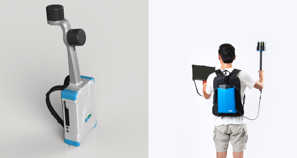
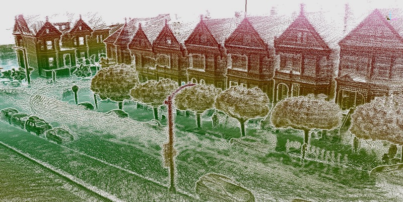
It wasn’t long ago that the idea of a laser-scanner that captured as you walk seemed like a dream. Now, it’s a growing market segment with a few brand-new additions: Berkeley-based Greenvalley International has announced two new lidar backpacks, the LiBackpack 50 and LiBackpack D50. Both scanners both feature ranges of longer than 50 meters (hence the name), and feature SLAM for real-time point cloud registration “in a diverse set of natural and built environments.”
As Kevin Ford, marketing and business development manager told SPAR, these devices both generate a variety of data types that can be viewed in real time on Greenvalley’s user interface. Connect to the scanner from your phone or tablet using WiFi, or from a laptop with an ethernet cable, to see intensity values, path of travel, number of survey loops completed, time stamp, and min-max distance filtering as you scan. The interface offers users a method for checking their data as you scan, an function that reduces the time in the field as well as the number of trips necessary to get a complete data set.

ILMF hall invert
The 50 and D50 models are both spec’ed out for use in forestry inventory, stockpile volumetrics, mining, and archaeology, or applications “where having a longer range without a lot of noise is necessary.”
Greenvalley is positioning the 50 as the more affordable model, and operates in two modes: hands-free (with the sensor mounted on the backpack) and “torch” (with the sensor held in the hand). The primary benefit of this set up is the ability to scan quickly with handsfree mode, and switch to torch mode when necessary to direct the scanner’s FOV and ensure full coverage of difficult areas.
The D50 includes two lidar sensors to the 50’s single sensor. One sensor is oriented horizontally, the other vertically, to capture the user’s environment faster. This is beneficial for the device’s SLAM algorithms, as Ford explains, “the more features and/or more distinguished features for it to yield and match, the better. With the D50 having two LiDAR sensors to feed inputs into the SLAM, allows for a higher accuracy (less accumulated drift error).”
Alongside the scanning hardware, users will get Greenvalley’s modular point-cloud processing software, LiDAR360. This application includes four modules, one for data management, visualizing, and classification; as well as specialized modules for terrain mapping, forestry, and power lines.
The software processes lidar from a variety of sources, including Greenvalley’s UAV lidar, or any terrestrial or aerial data sets you have collected. It offers the usual features you’d expect, as well as machine-learning classification in its Forest and LiPowerline modules.
“The Forest module,” explains Ford, “has toolsets for aerial and terrestrial laser scanners which offer automatic extraction of individual tree metrics. Our Power Line module has tools to automatically detect danger points such as overgrown trees, etc and simulate environmental variables that can effect the power transmission line such as line sag/sway under wind, ice coverage, temperatures. “
Ford says that Greenvalley is continually honing their machine learning algorithm for better performance, with an eye toward using it to classify 3D road maps in the future.
For more information about Greenvalley’s lidar solutions, including pricing, visit its website here.